Gallery: Satellite Images Reveal Damage from Ukrainian Dam Collapse
Apurva Mahajan June 16, 2023
Submerged Areas and Flooded Cities/Villages
This satellite image highlights in blue the areas surrounding the Kakhovka Dam that were submerged as of June 7. Highlighted in yellow are residential areas that were flooded as of June 7. More than 20 villages and cities located downstream from the dam were included in the over 50 acres flooded, according to NASA Harvest, a global food security and agriculture consortium led by NASA and the University of Maryland.

Reservoir Levels on June 5, 2023
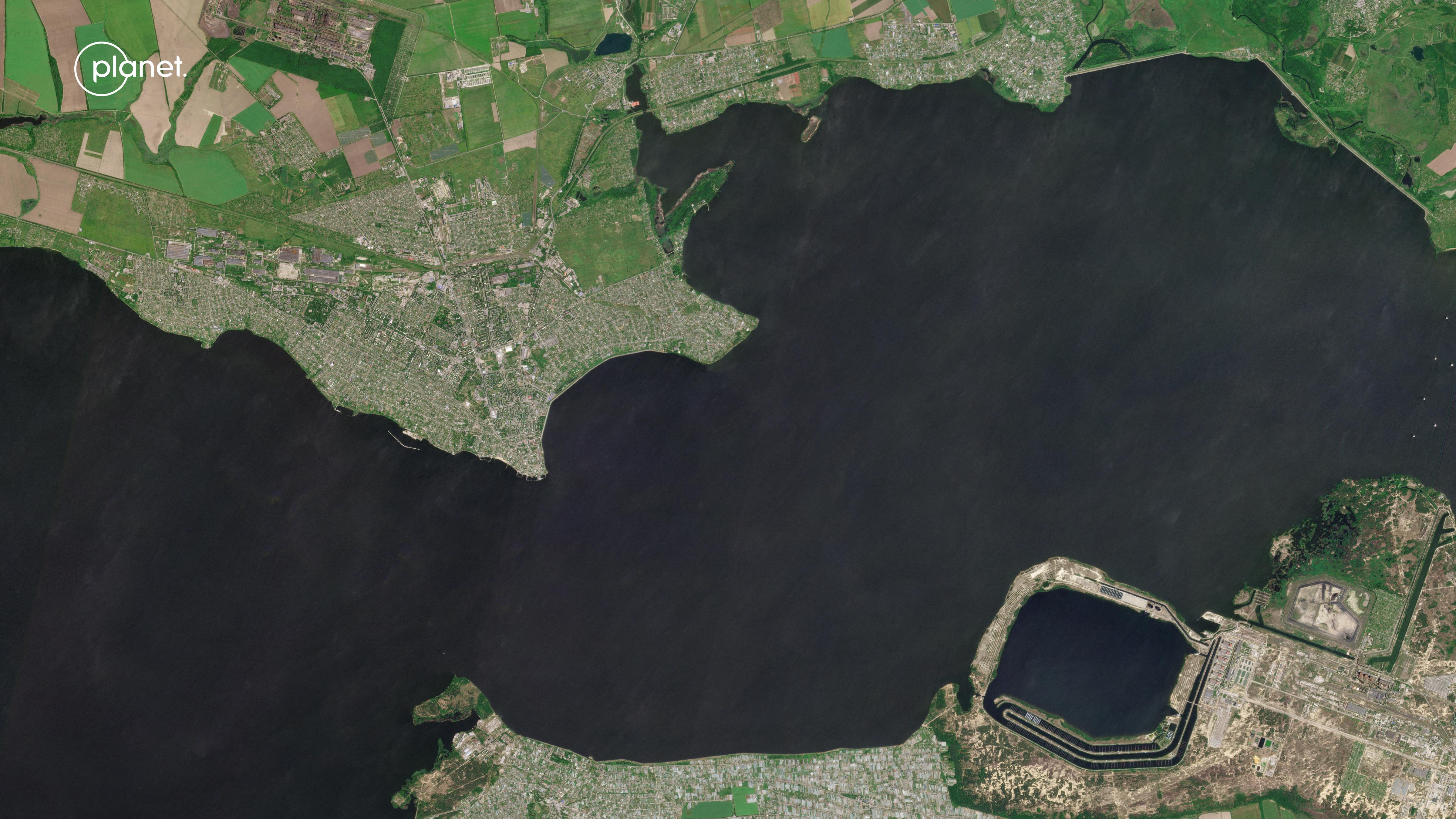
This satellite image shows the normal Kakhovka reservoir levels near the Zaporizhzhia Nuclear Power Plant, located along the Dnipro river. On June 5, a day before the dam's initial collapse, the reservoir was full, and the ground was not visible due to the volume of water the dam was holding back to fill the reservoir. The water is flush with the canal intakes here, indicating all of the canals were still connected to the rest of the canal system.

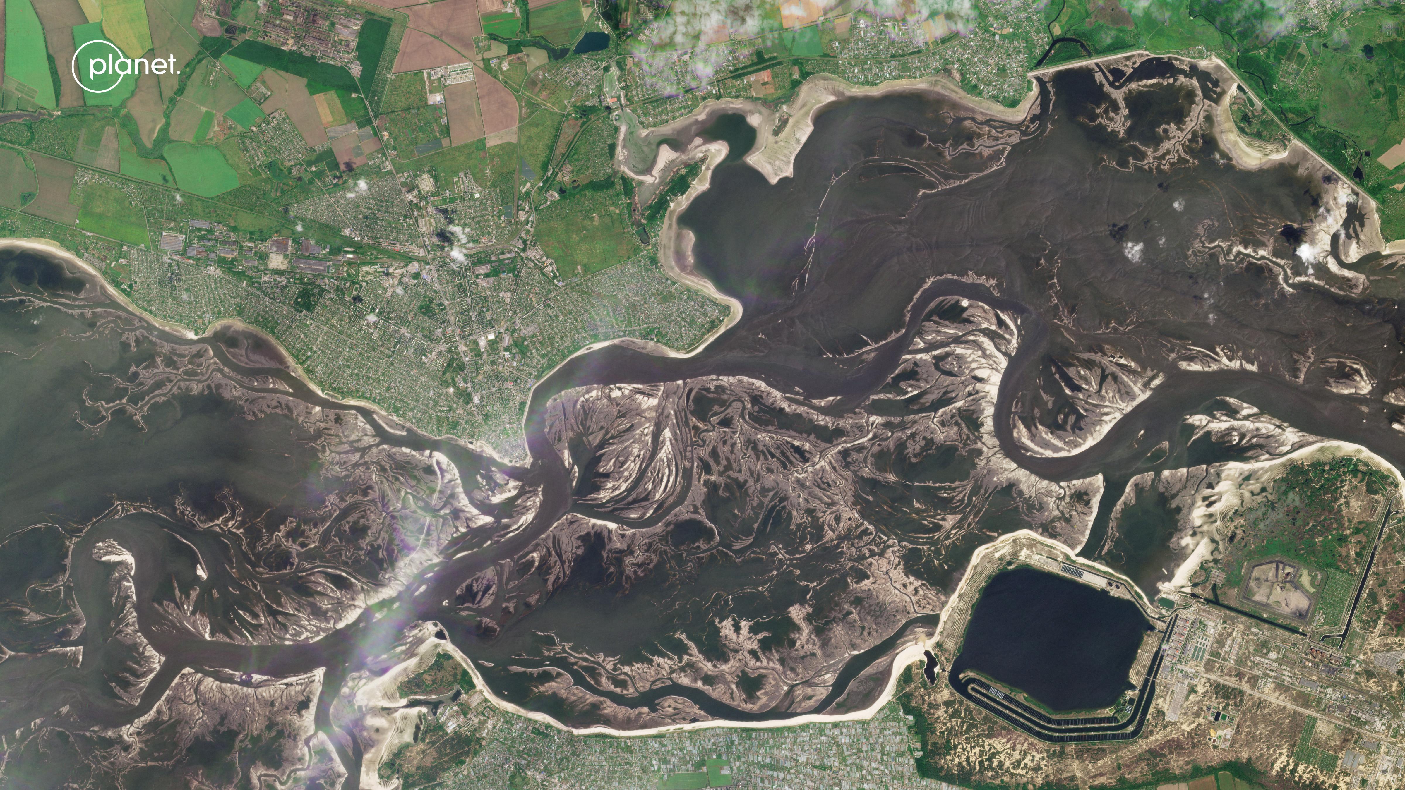
Reservoir Levels on June 13, 2023
Taken June 13, this image shows the Kakhovka reservoir levels after the dam collapse. Although the reservoir was previously abundant, the water level significantly receded to the point where the ground can be seen in areas that had been fully under water before.

Ukraine's Network of Canals
In the summer months, Ukraine relies heavily on four primary canal inlets for farm irrigation, shown in this image. The projected rainfall for this season is most likely insufficient maintain the crop health and yields of this land without irrigation.
According to NASA Harvest, three of these four vital canal inlets are already disconnected from the canal network, and the fourth is very close to disconnecting in the next few days.

Balky Canal Inlet
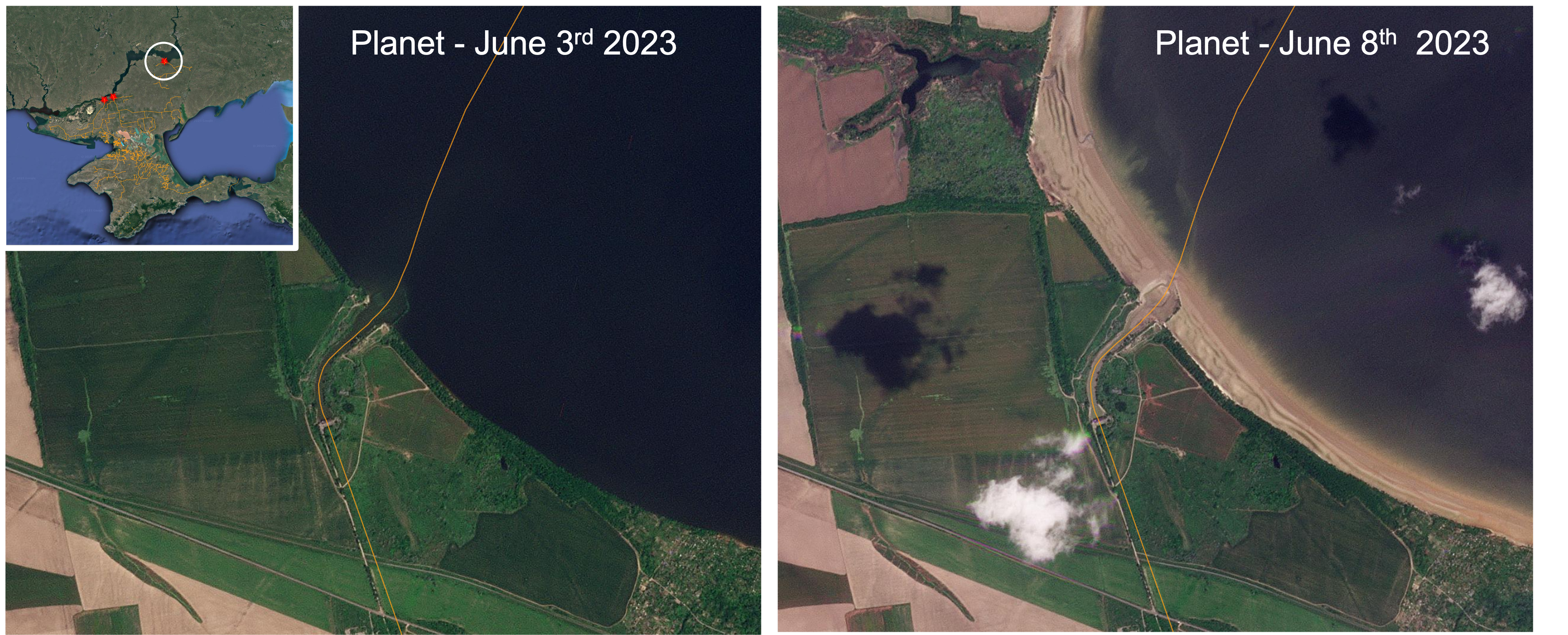
This side-by-side satellite view of Ukraine's northernmost canal inlet by the village of Balky shows the canal before and after it disconnected from the rest of the water supply on June 8. In the left image, dated June 3, the water clearly flows into the canal, but on the right, after the dam's collapse, the canal is unable to provide water to the rest of the system.

Maryanske Canal Inlet
After the canal inlet near Maryanske disconnected from the water supply on June 9, water levels receded to the canal inlet near Balky.

North Crimean Canal
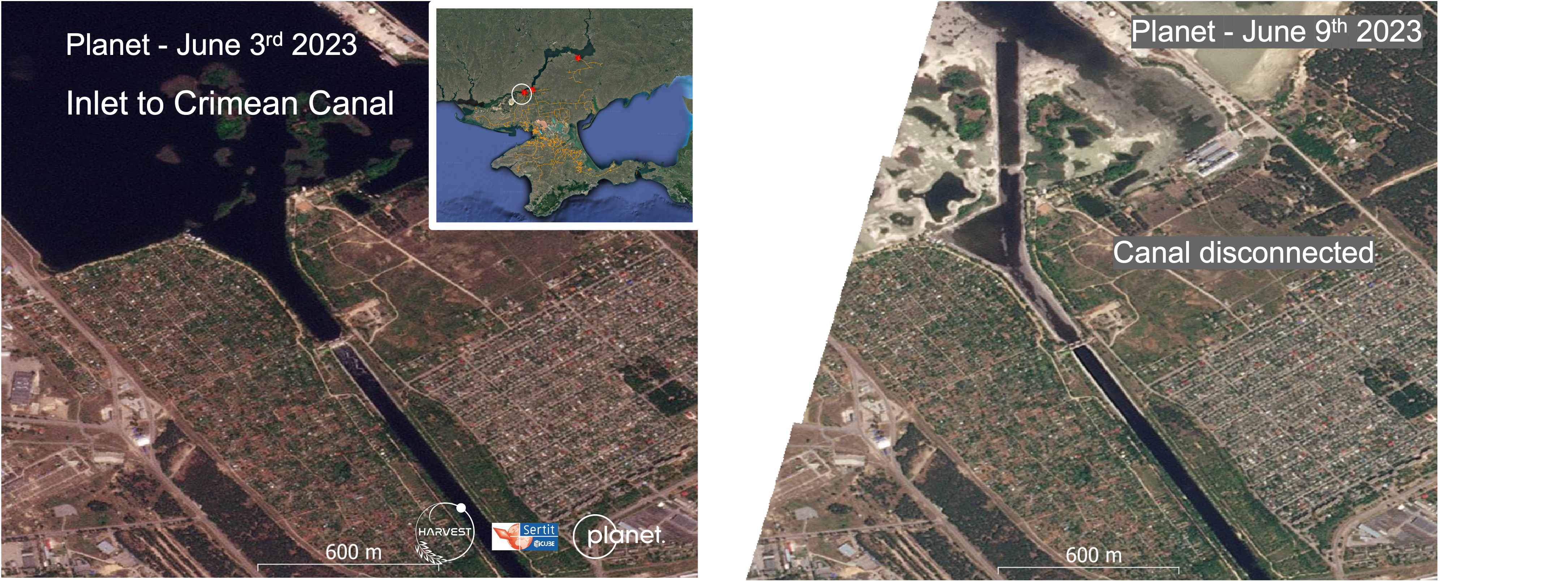
Less than a week after the first image was taken on June 3, the satellite image on the right captured the drastic receding of the water level surrounding the North Crimean Canal inlet on June 9, after it disconnected from the rest of the water supply.

Kakhovsky Canal Comparison
These satellite images show the Kakhovsky Canal, the last of the major canal inlets in Ukraine's expansive networks and one out of the four canals that is still connected to the water supply. The left image, taken June 5 before the Kakhovka dam's collapse, shows the canal in its normal state. On June 9, three days after the dam's collapse, the right satellite image captured the water level slowly receding. The Kakhovsky Canal intake is still connected and able to irrigate, unlike the other three, but the canal is expected to disconnect in the coming days.

Flooded Cropland
This satellite image provides a look at the distribution of the types of flooded land in the impacted area as of June 7. The total flooded area as of June 7 is estimated by NASA Harvest to be 410-420 km2, 3.5-5 km2 of which is cropland. Flooded cropland is denoted in red on this image, non-cropland is green, and open water is marked blue.

Receding Waterline
In the days following the initial destruction of the Kakhovka Dam, satellite images captured the waterline receding from the far northeast regions of the reservoir on June 9.
Ukraine’s Kakhovka Hydroelectric Power Plant Dam, located in Russian-occupied Nova Kakhovka in Kherson Oblast, collapsed June 6 following an explosion, flooding the surrounding agricultural land, villages and towns as well as displacing thousands of residents.
The cause of the explosion is still unclear, as both Russia and Ukraine claim it was caused by the other. The total flooded area is an estimated 410-420 km2, 3.5-5 km2 of which is cropland, according to NASA Harvest, a global food security and agriculture consortium led by NASA and the University of Maryland.
The reservoir that the dam previously held back had supplied water to an estimated 12,000 km of irrigation canals. Combined with the flooded cropland, the now partially disconnected canal system could have concerning implications for food and water security. Additionally, according to a statement from Ukrainian President Volodymyr Zelenskyy's office, the Dnipro River on which the dam sits on has been contaminated with 150 tons of machine oil, a significant environmental concern.