Manufacturers, suppliers and developers have made numerous recent advances in drone data exploitation, flight-control and airspace management, announcing new products that also may have application for future advanced air mobility vehicles. Some of the major developments are summarized below.
C-Band Command And Control Radios
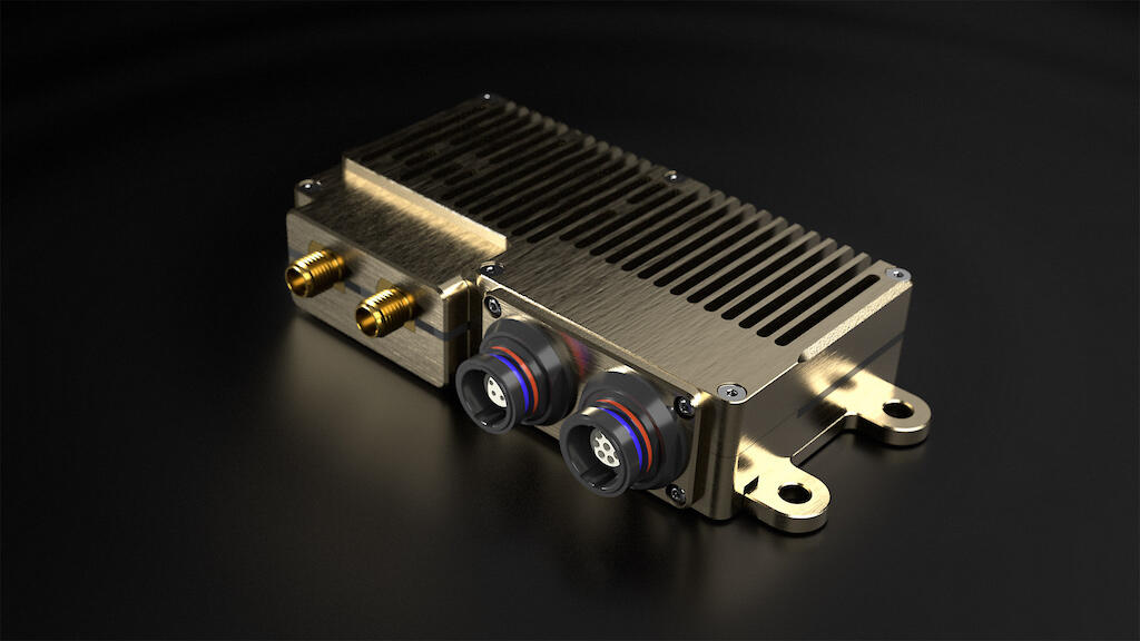
uAvionix has received FAA approvals to test its SkyLink command and control (C2) radios for unmanned aircraft systems (UAS) on aviation-protected C-band frequencies and has expanded its plans to deploy a “SkyLine” network of C2 ground and airborne radios at new locations in the U.S. and Canada.
The FAA has authorized uAvionix to test its C-band C2 radio design for compliance with RTCA DO-362A and an eventual TSO-C213A at Bigfork, Montana, and the Northern Plains UAS Test Site in North Dakota. Currently, the SkyLine system uses the uAvionix microLink airborne radio system and skyStation2 ground ratio system hardware, operating on unlicensed ISM 902-928MHz frequencies.
SkyLine is the first certifiable C2 network purpose-built to support the move to beyond-visual-line-of-sight (BVLOS) operations for UAS and Advanced Air Mobility vehicles, uAvionix said. The company intends to transition all SkyLine infrastructure to aviation-protected C-band frequencies, offering operators a secure network to support their mission safety case.
Initially deployed in partnership with Thales as part of the North Dakota Vantis initiative, the SkyLine C2 network will be expanded for the North Dakota test site and across other UAS test sites under the FAA’s Beyond program, including at New Mexico State University, the Choctaw Nation of Oklahoma, the Pan-Pacific UAS Test Range Complex in Alaska, and the Tillamook UAS test range in Oregon operated by Near Space Corporation.
https://marketplace.aviationweek.com/company/uavionix
GPS Signal Protection Systems

Honeywell Aerospace signed a collaboration agreement with Israel-based InfiniDome to jointly GPS signal protection systems for a wide range of vehicle platforms, including commercial aircraft, urban air mobility vehicles, unmanned aircraft systems and surface vehicles.
The Honeywell-InfiniDome partnership combines Honeywell’s expertise in navigation sensors with InfiniDome’s GPS resilience technology. The systems will include hardware, software and services, with a first product expected to be commercially available in the first half of 2022.
“Intentional GPS jamming and spoofing incidents are on the rise, and this partnership will enable a rapid solution to this critical industry need,” said Matt Picchetti, Honeywell Aerospace general manager for navigation and sensors. “This partnership will create world-class solutions that will help accelerate the future of flight, especially in urban areas.”
https://marketplace.aviationweek.com/company/honeywell-aerospace-0
Drone Detect-And-Avoid
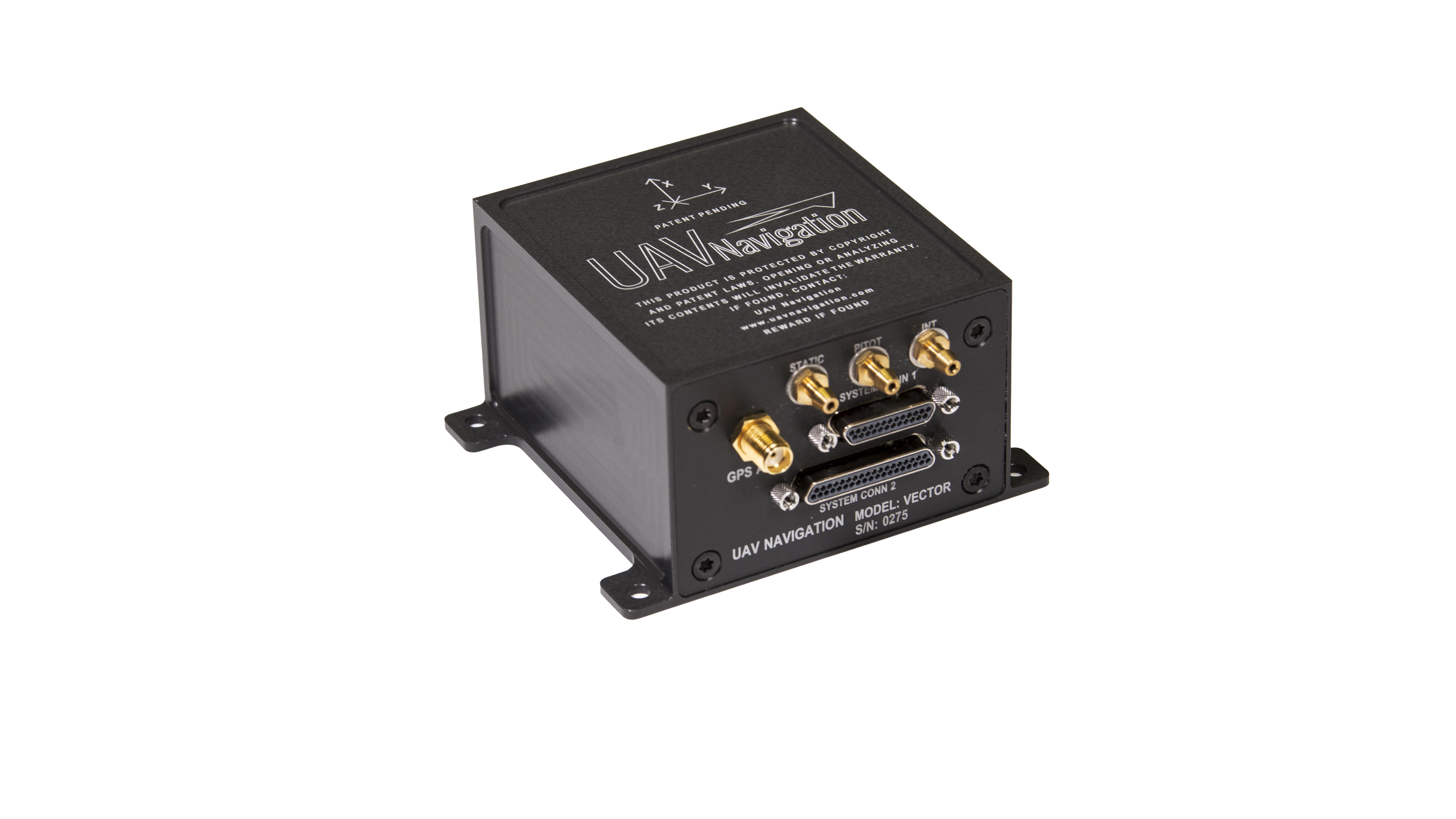
Drone autopilot manufacturer UAV Navigation is integrating Iris Automation’s Casia detect-and-avoid software in its Vector autopilot line.
Unmanned aircraft equipped with Vector and Casia can detect uncooperative, crewed aircraft in their airspace and autonomously or manually take corrective action, avoiding potential collisions.
Vector autopilots are designed to execute flight completely autonomously, even if the remote-control datalink becomes unavailable or fails. Flight-control systems produced by UAV Navigation, based in Sebastian de los Reyes, Spain, are used for high-performance tactical unmanned planes, aerial targets, mini-unmanned aircraft and helicopters.
https://marketplace.aviationweek.com/company/uav-navigation
Iris Automation recently released Casia Software v2.2. Casia software uses computer vision and artificial intelligence to detect and classify aircraft intruders, similar to human pilots.
https://marketplace.aviationweek.com/company/iris-automation
Modular Airspace Management System
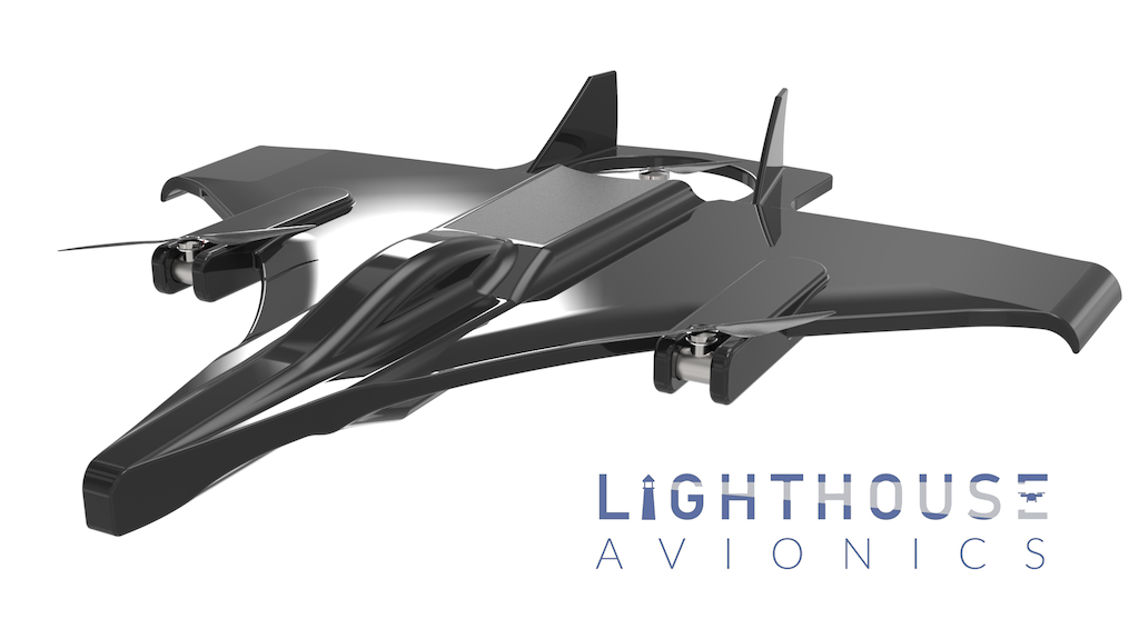
Start-up Lighthouse Avionics of Hilliard, Ohio, has received a $100,000 grant from the Ohio Third Frontier Commission, a state economic development organization, to advance its low-cost airspace management system for drones.
Lighthouse’s system replicates the functionality of the national airspace system, providing long-range identification, tracking and communication for drones flying below 400 ft. It is based on three components: a Virtual Control Tower (VCT), an operator’s workstation and fully autonomous integrated drones.
A VCT is a permanent structure that can be mounted to cell towers or school building rooftops; it integrates radar, optical, communication, acoustic and weather sensing into a single system. A receiver allows any drone to communicate its position to the towers.
The integrated Lighthouse Intelligent Drone Systems are fully autonomous, artificial intelligence-guided unmanned aircraft equipped with a high-definition optical and infrared camera payload and built-in safety features including a parachute.
Lighthouse Avionics is the first portfolio company of Converge Ventures, an Ohio-based start-up studio. Lighthouse’s out-of-the-box drone solution is intended for municipalities and first responder agencies that require limited training and no certified operator.
The company is working with the FAA, the state and the city of Hilliard on a pilot project roll-out, which will integrate six virtual control towers to support two Lighthouse drones operating over 13.5 square miles.
“The Lighthouse drone system is developed by and for first responders,” says Eric Grile, Hilliard deputy police chief. “The technology will have a dramatic effect on shortening response times, meaning more intentional deployment of valuable city resources and less wasted time and personnel.”
https://marketplace.aviationweek.com/company/lighthouse-avionics
Plug-And-Play Camera Payloads
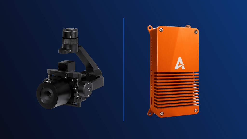
Drone enterprise software developer Auterion, based in Zurich, has partnered with aerial photography system manufacturer Phase One of Copenhagen to integrate the Phase One P3 Payload line as a plug-and-play system.
Drones using the Phase One P3 Payload and Auterion’s Skynode and Suite are capable of performing time-critical inspections including those of wind turbine fields, oil refineries and offshore rigs, power masts and utility lines, bridges, dams, nuclear facilities, large infrastructure projects and other use cases. The combination also supports faster geospatial mapping with very high resolution, dynamic range, color fidelity and geometric accuracy.
The Phase One’s P3 Payload consists of a high-resolution 100MP iXM camera containing a BSI sensor with the highest dynamic range of 83dB, a rangefinder with smart focus and a broad array of lenses, including 35 mm, 80 mm and 150 mm.
Auterion also announced a partnership with thermal imaging sensor manufacturer Workswell, of the Czech Republic, to provide bispectral cameras on drones that are used across industries. Auterion, with 70 employees, has offices in Switzerland, Germany and California, and lists GE Aviation, Quantum-Systems, Freefly Systems, Avy and the U.S. government as customers.
https://marketplace.aviationweek.com/company/auterion
OpenSky Airspace Access App
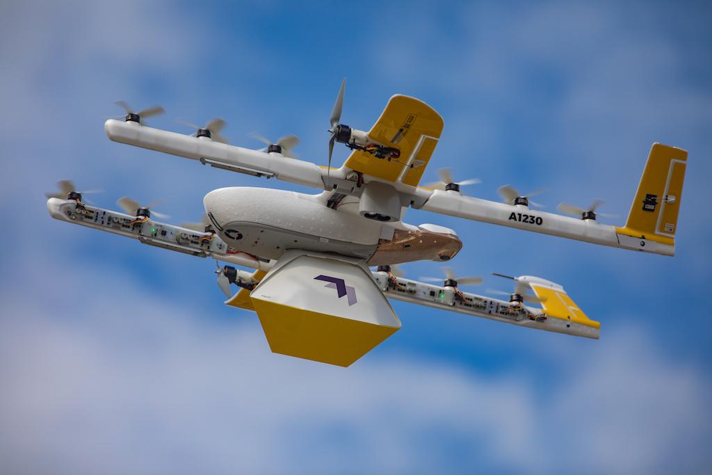
Alphabet Wing made its drone flyer app, OpenSky, available for free in the U.S., through the Google Play and Apple app stores.
With OpenSky, recreational or commercial drone flyers can check FAA airspace information to see where they can and cannot fly, request permission from the FAA to fly in certain airspaces, and manage, and log their flights and permissions to their pilot profile. The app is adapted from the software Wing uses to manage its commercial drone delivery operations in Christiansburg, Virginia, as well as in Helsinki and two locations in Australia.
The FAA has approved OpenSky as a Low Altitude Authorization and Notification Capability (LAANC) supplier, allowing the app to function as a real-time authorization tool for drone flyers wishing to operate in LAANC-controlled airspaces, which include areas surrounding hundreds of airports throughout the U.S.
Without an FAA-approved LAANC supplier such as OpenSky, drone fliers would need to request authorization to operate in these areas days or weeks in advance. OpenSky can enable authorizations in seconds for operations like emergency response, commercial surveys or film and photography sessions.
https://marketplace.aviationweek.com/company/wing

Related Content