Satellite- and Aircraft-Acquired Imagery Give Firefighters a Critical Edge
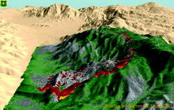
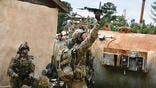
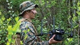
Incident commanders and air tanker pilots battling U.S. forest fires are capitalizing on commercial satellite imagery, advanced infrared sensors developed by the Pentagon, and network-centric warfare-like communications. As they become widely available, these tools will give aerial firefighters the...
Subscription Required
This content requires a subscription to one of the Aviation Week Intelligence Network (AWIN) bundles.
Schedule a demo today to find out how you can access this content and similar content related to your area of the global aviation industry.
Already an AWIN subscriber? Login
Did you know? Aviation Week has won top honors multiple times in the Jesse H. Neal National Business Journalism Awards, the business-to-business media equivalent of the Pulitzer Prizes.
Related Content