This article is published in Aviation Week & Space Technology and is free to read until Mar 01, 2025. If you want to read more articles from this publication, please click the link to subscribe.
Canada And Norway Use Microsatellites To Hunt ‘Dark’ Ships And Aircraft

Canada and Norway are pushing microsatellite surveillance of the Arctic using a combination of sensors.
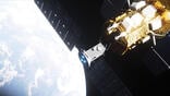
Ships and aircraft sneaking about the Earth’s northern latitudes are raising alarms with NATO allies, and Canada and Norway are looking to do something about it.
The two Arctic countries are trying to tackle the scourge of “dark” fleets of aircraft and ships that broadcast false location, altitude, heading or identity data or go completely dark. Canada launched a trio of satellites in January called Gray Jay, while the Norwegian Space Agency deployed the NorSat-4, carrying specialty cameras to help with identification.
- Countries test space-based surveillance of High North
- Low-cost small satellites are increasingly capable of keeping watch over the Arctic
The issue is becoming more salient as melting sea ice makes the Arctic Ocean easier to traverse, allowing cargo, fishing, oil and gas, and naval vessels to operate closer to Canada and Norway. Recent anchor-dragging incidents by Russian and Chinese civilian ships, which have cut communications and power cables at the bottom of the Baltic Sea, are raising national security concerns. The northern latitudes are a possible Chinese or Russian aircraft avenue of attack on Canada and the U.S.
To get a better handle on ship and aircraft activity, Defense Research and Development Canada (DRDC) launched three formation-flying microsatellites as part of its Gray Jay Arctic surveillance technology demonstration mission. Weighing 30 kg (66 lb.) each, they are to fly in a sun-synchronous orbit of 520 km (323 mi.).
The microsatellites are to fly in a relatively close formation, about 600 km apart in the long-track direction. By flying in a cluster, the three satellites can triangulate the position of radio and radar transmissions.
The satellites carry Automatic Identification System (AIS) receivers for tracking ships, Automatic Dependent Surveillance–Broadcast (ADS-B) receivers for tracking aircraft and software-defined radios to sniff out ships or aircraft emitting S-band and L-band signals. To verify location of ships and aircraft, one satellite carries an infrared thermal camera.
“The primary mission is [radio frequency] geolocation for immediate targets,” says Jeff Secker, defense scientist and Gray Jay project lead with the DRDC. “We have a stretch goal of cuing the thermal [infrared] camera.”
The S-band and L-band radio frequency sensors onboard the satellites could help detect the navigation radars or communications transmissions of dark aircraft or ships, he adds. “All ships need to use navigation radar, especially in the Arctic with the ice and the darkness,” Secker says.
Space Flight Laboratory (SFL), part of the University of Toronto Institute for Aerospace Studies, manufactured the Gray Jay demonstration satellites and the operational NorSat-4 satellite. SFL specializes in developing low-cost cubesats and other small spacecraft. The lab honed its expertise in triangulating electromagnetic emissions by developing satellites for space-based radio-frequency detection company HawkEye 360.
Davor Mihajlovic, DRDC project manager for the Gray Jay demonstration, emphasizes the satellites are for research and development purposes only and will not be operationalized. However, he notes the technology could be used to complement the joint U.S.-Canadian North Warning System, a ground-based early-warning radar system that monitors airspace in North America’s polar region.
“If you’re monitoring something 1,000 km away with something like the North Warning System, at those distances the picture does not come down all the way to the surface,” he says, noting radar obstacles like the curvature of the Earth and mountains. Satellites can sense all the way to the Earth’s surface, especially important for tracking vessels in the Arctic, he adds.
To better surveil its maritime environment, the Norwegian Space Agency’s NorSat-4, a 35-kg microsatellite, carries an AIS ship-tracking receiver as well as a low-light imaging camera developed by Safran Reosc of France. The camera is designed to work in darkness and detect light emanating from vessels longer than 30 m, SFL Director Robert Zee says.
SFL has built five NorSat spacecraft, including one technology demonstrator and four operational spacecraft. NorSat-3, launched in 2021, carries an experimental navigation radar detector to find dark ships.
Because the microsatellites developed for Norway and Canada use passive sensors—infrared and low-light cameras, as well as radio receivers—they are less power hungry than a synthetic aperture radar satellite, Zee says. The satellites are also relatively less expensive.
For example, the three Gray Jay satellites cost about C$16.3 million ($11.3 million) to develop and launch, Secker says. A central question the Gray Jay project is trying to answer, Mihajlovic says, is if the lower-cost microsatellite clusters can achieve the same outcome as a larger, more expensive conventional spacecraft.