Shuttle Radar Maps Improve Worldwide Topographic Data
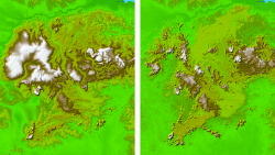
TOPO MAPS U.S. government mapmakers have used data generated by a synthetic aperture radar mounted on the space shuttle Endeavour over a 10-day period in February 2000 to produce the highest quality topographic map of the world yet, at least beneath the 60-deg. inclination orbit the shuttle followed...
Subscription Required
This content requires a subscription to one of the Aviation Week Intelligence Network (AWIN) bundles.
Schedule a demo today to find out how you can access this content and similar content related to your area of the global aviation industry.
Already an AWIN subscriber? Login
Did you know? Aviation Week has won top honors multiple times in the Jesse H. Neal National Business Journalism Awards, the business-to-business media equivalent of the Pulitzer Prizes.
Related Content