Supporting the Mission for a More Weather-Resilient Nation

L3Harris advanced imagers on board NOAA weather satellites are helping detect and track disasters that threaten lives and property.
From heavy windstorms to atmospheric rivers to devastating tornadoes, severe weather events have already caused more $7 billion in damage across the U.S. in the first half of 2024. L3Harris is delivering advanced technologies that help the National Oceanographic and Atmospheric Administration (NOAA) better predict and prepare for whatever comes next.
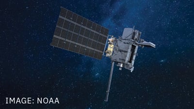
NOAA and NASA successfully launched L3Harris ' Advanced Baseline Imager (ABI) into orbit June 25 on its Geostationary Operational Environmental Satellite (GOES)-U – the fourth and final satellite in the NOAA GOES-R Series of advanced weather satellites. The ABI is the most sophisticated meteorological imager ever created and is now the primary instrument on board all four GOES-R Series satellites.
Initially launched in 2016, the ABI collects weather, climate, ocean and environmental information with unprecedented speed and accuracy. It can simultaneously track a single storm and gather precise imagery from more than 22,000 miles away from Earth – all from one of the harshest environments known to mankind. Equipped with the data provided by our ABIs, scientists and forecasters can better identify potential hazards that could impact daily life including fire, smoke, fog, ash clouds and much more.
It's safe to say that extreme weather is a new normal, making space-based weather observation even more critical to protecting lives and property. With the advanced imager powering the entire GOES-R constellation, NOAA is even better positioned to better understand, predict and counteract these increasingly dangerous weather threats.
 L3Harris supports GOES-R from the ground, too. Our highly scalable enterprise ground and antenna systems capture and process vast amounts of data from the GOES-R Series to deliver information and products to users worldwide. NOAA awarded L3Harris the ground segment contract in 2009 and the ground segment antennas contract in 2010. The partnership has flourished over the years, with multiple upgrades and contract extensions.
This complex network of technologies, including antennas and high-performance computing, works together to bring satellite data down to Earth, process it and then reliably distribute the resulting data products to thousands of direct users worldwide, such as forecasters, research scientists and the public. This is done in near real-time, 24/7, to ensure that those in harm 's way have enough advanced notice to evacuate or find shelter.
L3Harris recently earned a contract to extend the system's functionality. L3Harris is also implementing high-performance computing, machine learning, artificial intelligence and advanced antenna technologies to ensure the U.S. has scalable, secure and reliable ground systems that deliver life-saving weather information faster than ever before.
Eyes on the future: Supporting the GeoXO mission
An increasingly volatile climate demands continual innovation to keep people safe – which is why L3Harris is already working on next-generation technologies that will enable NOAA to do just that. The company is providing next-generation imagers and sensing technologies to NOAA's Geostationary Extended Observations (GeoXO) imager, which will eventually replace the GOES-R Series to enable the most timely, detailed and accurate weather forecasts to date.
For GeoXO, L3Harris is building on the advanced technologies contained in our GOES-R Series ABI technology and to further enhance our nation 's forecasting abilities. The first GeoXO satellite is expected to launch in the early 2030s as the GOES-R Series satellites reach the end of their operational lifespan.
Related Content