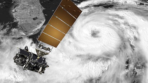
Credit: L3Harris Technologies
Since its formation, the U.S. National Oceanic and Atmospheric Administration has set the bar for gathering and distributing data about the planet for weather prediction, storm tracking and meteorological research. Now, faced with increased demand for its services and with new Earth-observing...

After 50 years, NOAA Looks To Shake Up Status Quo is part of our Aviation Week & Space Technology - Inside MRO and AWIN subscriptions.
Subscribe now to read this content, plus receive full coverage of what's next in technology from the experts trusted by the commercial aircraft MRO community.
Already a subscriber to AWST or an AWIN customer? Log in with your existing email and password.
Related Content