In the first part of this article series, we discussed convective air currents and shifting winds in the vicinity of mountains.
An inherent risk with mountain flying includes rapidly changing conditions and the localized nature of mountain weather. The college students on the May 2019 Global Engagement trip had a perfect illustration of this aspect of mountain meteorology during our ascent to the Urmiberg aerial tram station above Brunnen, Switzerland. Our host, “Reto,” had spent a career as an aerial tour operator in Switzerland’s Bernese Alps. From the comfort and safety of our scenic overlook Reto pointed out features of the rapidly changing weather that would pose a risk to flight operations.
While savoring luscious fondue, the students were led in a lively scenario-based discussion: “You are an EMS pilot tasked with rescuing an avalanche victim on this mountainside. Describe the weather threats to your aircraft and what can you do to mitigate those threats?” This was an opportune location to safely observe the rapid weather changes evident in the nearby valleys and canyons.

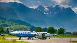
Near the conclusion of this trip, we toured Rega’s facility in Zürich. After these scenic hikes in the Alps the students had a good understanding of the challenges of aviation operations in alpine terrain weather. Rega’s staff gave the students a thought-provoking presentation on the development of their systems to safely conduct rescue operations in this potentially unforgiving alpine environment. Up-to-date weather information and communication devices that transmit real-time information to the cockpit are a vital component of their system. In order to be able to operate all-weather flights, up-to-date weather data needs to be available around the clock. Without this information, IFR flights are not permitted. Rega's major project, known as "Thor," provides more weather data for helicopter operations. This effort included installing approximately 60 new weather stations and webcams at key locations throughout the Swiss Alps.
Terrain Magnifies Lifting Action
Throughout the year, aviation students are invited on similar field trips to the top of the Snowbird ski resort in Utah. From the top of the gondola at 11,000 ft., the students have a commanding view over three airports separated by a tall, steep mountain range, all situated in different micro-climates. When the group comprises skiers, we deliberately traverse across the expansive resort to sample the variations in the micro-climates, from the acceleration zones of the wind on the windward sides of a ridgeline to the deceleration zones in the wind shadows, and to the Venturi effect on the wind between adjacent peaks.
The students have observed incoming weather fronts that were fairly benign as they approached over flatter terrain, but upon reaching the mountains the lifting action intensified the front. One group of students experienced an especially noteworthy lesson on a late spring day. We were standing next to the top of the tram taking pictures. Initially the skies above our heads were clear and sunny. Within minutes, however, the skies darkened around us. While posing for the final picture I commented with concern, “It’s time to get down off the top.” Moments later the ski patrol started restricting access to the top of the mountain, clearly out of concern for the convective activity. A few minutes later, we sat comfortably (and safely!) in the mid-mountain lodge as thunder reverberated off the mountain terrain.
Thanks to internet connectivity the students could visually observe the approaching weather from this elevated position as well as look at the current radar returns. This provided a number of valuable learning lessons about the effects of orographic lifting on a slightly unstable air mass and the correlation of weather interpretation with weather radar returns.
This was a priceless real-world lesson that could not have been conveyed as effectively in a classroom setting.
Topography Creates Micro-Climates
Temperatures can vary widely in just a small distance due to localized topography and micro-climates. A group of students received a first-hand demonstration of this concept during an avalanche awareness training course that included avalanche dogs, ski patrollers and EMS pilots. One of the tasks was to evaluate the structure of the snowpack. This was important for the pilots to help them gauge if underlying crusts would catch a helicopter skid and cause a dynamic rollover during a mountain rescue.
The first location where we dug our snow pit was a brisk -25F. These temperatures were too cold for standing around, so we were glad to climb some gentle terrain nearby. Although we had ascended a mere 100 ft., the temperature had warmed significantly to -4F. This was an obvious temperature inversion, a weather phenomenon that is common during calm weather in mountain valleys and bowls. Not only will this cause localized weather, such as the formation of patches of fog, but it also can affect an aircraft’s performance predictions. If you are utilizing the air temperature reported by a low-lying ASOS of -20F, the mere change of 100 ft. in elevation warms the temperature markedly under the influence of these common temperature inversions. This is an especially effective teaching setting because periods of strong temperature inversions during the winters in the mountainous often lead to deteriorating air quality and visibility at the commercial airports that sit at the lowest elevations in these valleys.
All of the gondola rides provide an ideal platform for observing the temperature variation. Depending on the location, some of these gondola trips involve multiple stages and gain over 7,500 ft. On some days, the temperature variation follows a predictable lapse rate, roughly 4F per thousand feet in elevation gain. On other adventures, the temperature variation has been non-standard, sometimes with substantial decreases in temperature with elevation gain, and sometimes with temperature inversions.
Another fun field trip invited students to participate as ground crewmembers assisting with the launching and landing of hot-air balloons. Students have observed the funneling of wind between adjacent hills creating a Venturi effect and observed the many layers of air moving in different directions on mornings that appear relatively calm.
In the final part of this article series, we’ll discuss more details of the Global Engagement trip to the Swiss Alps.

Related Content