Prior Experience
Credit: James Albright
If you’ve never flown into Aspen-Pitkin County Airport/Sardy Field (KASE), Colorado; Eagle County Regional Airport (KEGE), Colorado; Friedman Memorial Airport (KSUN), Hailey, Idaho; Jackson Hole Airport (KJAC) Wyoming; Truckee-Tahoe Airport (KTRK), California; or other airports nestled next to large areas of cumulous granite, you need to talk to someone who has. Looking at an instrument departure, arrival or approach procedure can give you a false sense of confidence that what is to come is perfectly normal. It most certainly is not.
I remember my first time flying into Eagle as a new copilot in a new flight department with a seasoned captain who had been there once before. He flew the LDA DME Runway 25 just as depicted, causing the Enhanced Proximity Warning System (EGPWS) to go nuts (with me wanting to go nuts along with it). After the “Terrain, terrain!” warning went quiet, we got a few “Pull up! Pull up!” alerts as he dove for the runway. My first thought was we should go around but staring at the mountains in front of us told me that would be no easier. Somehow, I was unable to predict any of this from the approach chart or his approach briefing. Clearly, I was unprepared. The captain shrugged it off as just the way things are when landing at a mountainous area airport. I picked up the phone and started calling people who knew about this type of flying, something I should have done well before this flight.

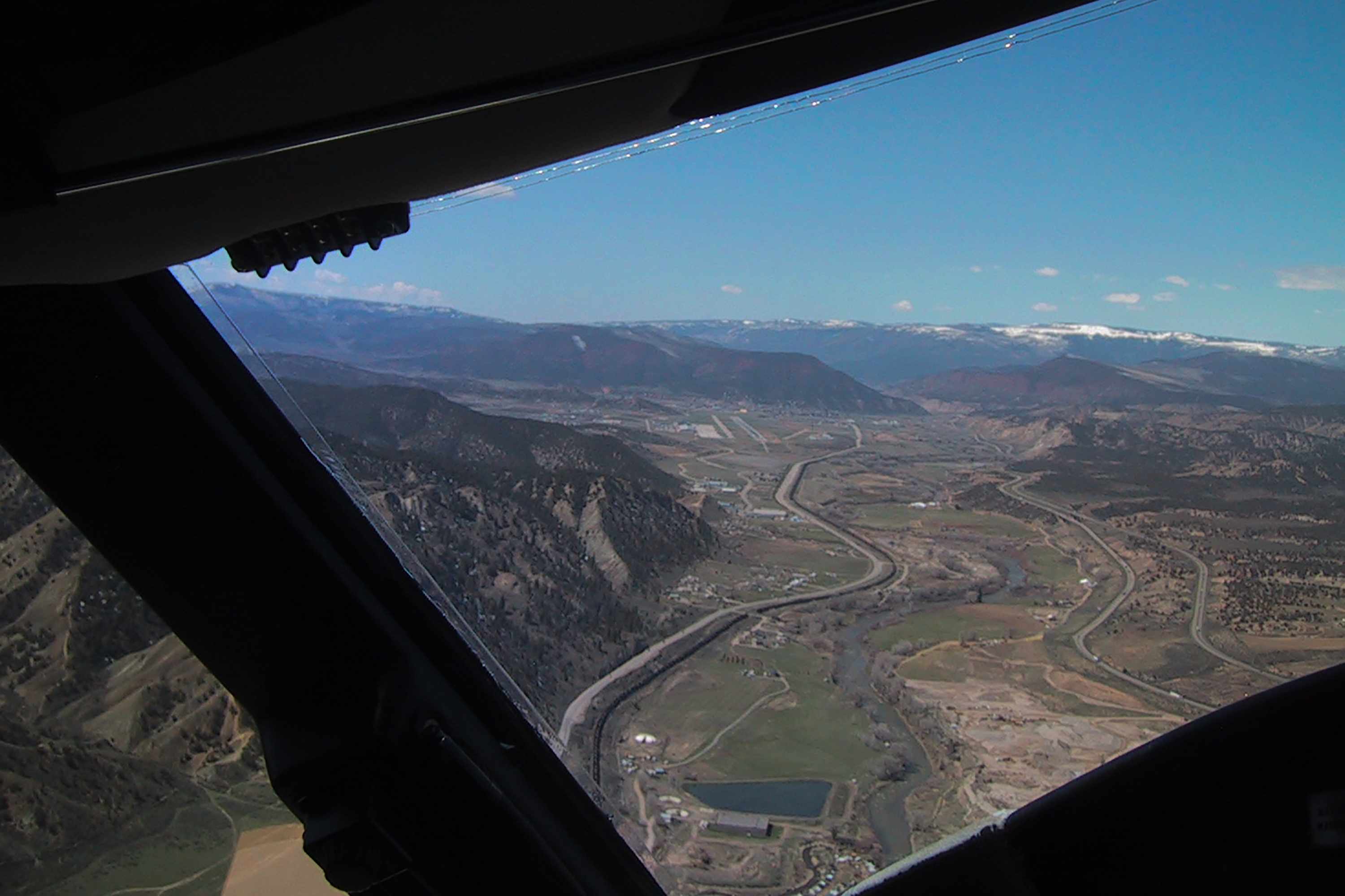
Ground Proximity Warning
Photo and Video Credit: Jason Herman
Over the years, I became the seasoned mountainous airport veteran and learned the EGPWS doesn’t need to go nuts (with me right behind it) and the descent rates do not need to violate stable approach limits. In short, you can make arrivals and departures from a mountainous airport, well, normal. You just need to know how to prepare.
My second approach into Eagle was much smoother than the first, because I learned that published weather minimums are unrealistic, real weather minimums are much higher. I learned that if you don’t see the runway at the waypoint prior to the terrain about eight miles east of the airport, you shouldn’t be descending. Finally, I Iearned that once you see the airport well east of those mountains, you can descend north of the mountains, keeping the EGPWS happy. And that meant your descent becomes more gradual, keeping stable approach rules happy. I learned these techniques from someone who had flown into and out of Eagle dozens, if not hundreds of times. And that gave rise to a checklist that makes any mountainous airport arrival or departure much easier.

Local Knowledge
Photo Credit: Steven Foltz
On the face of it, the challenge is a simple one: arrive and depart while avoiding all obstacles and not upsetting anyone in the airplane or on the ground. (A lot of these airports are noise sensitive.) But the actual mechanics of how to do that involves more than just big, powerful engines. It also requires an aircraft that can descend smartly and navigate precisely. You can get a quick overview of what is needed by asking someone who has done it before, preferably in a similar aircraft. You can find local knowledge as close as your own airport, user’s groups, or posted in airport directories and flight planning services.
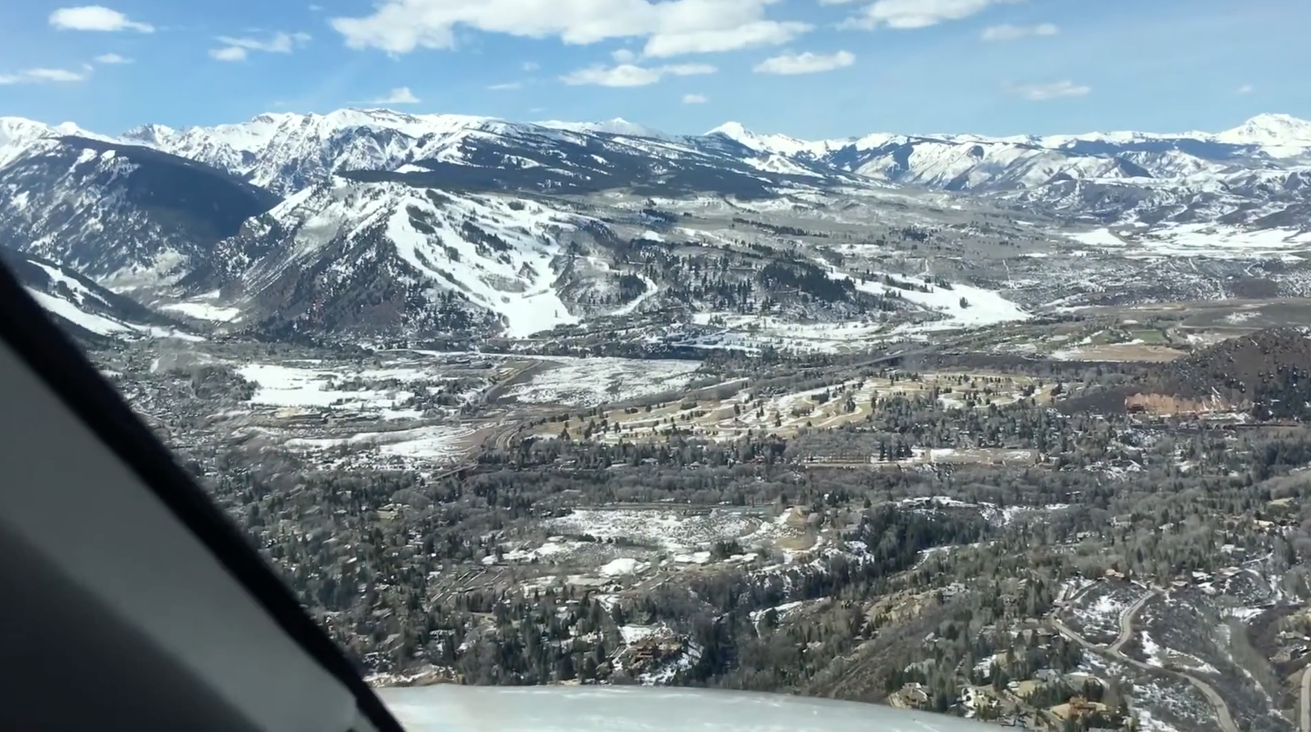
Official Intel
Credit: www.aspenairport.com
Most of these challenging airports have very good website pages with things you will need to know before taking off from “home plate” for ski country. Is there a slot reservation system in place? Are there parking restrictions for certain size aircraft? Which arrivals and departures are expected, and which are on the books for only certain operators? If you are going to Aspen-Pitkin County Airport/Sardy Field, for example, your mission planning should include a visit to www.aspenairport.com.
Another great source of airport information is AC-U-KWIK, where you will find worldwide airport, FBO, and handler data. That little book you’ve kept in your cockpit all these years is available online at www.acukwik.com.
Don’t neglect the FAA’s chart supplement, also known as the Airport/Facility Directory, available at www.faa.gov. Pay close attention to runway slope, declared distances, hours of operations and any restrictions that could allow you to land when you want, but not leave when you want.

Airport and Local Support
Photo Credit: Vail Valley Jet Center
You should make a call to the FBO, if available, or airport operations office otherwise. Ski season, weather and airport construction can make procedures from your last visit obsolete for your next. Hangars might be available, but usually require reservations be made well in advance. These airports have been known to run out of fuel, deicing/anti-icing fluid, and other items of support you might have taken for granted. During peak tourist season, hotel rooms, rental cars and other necessities can become rare commodities.

Situational Awareness
Photo Credit: Google Earth
You can start with an old-fashioned sectional chart or terrain chart, if available, to get a good idea about what the real obstacle threats are. But you should go one step further and test fly the procedures with a good earth mapping application. You can, for example, get a good view of the airport and flight paths using the 3-D tools available with ForeFlight and on Google Earth. (https://earth.google.com)
Look also for ground references, such as rivers and highways. Many professional pilots become so fully immersed in an IFR world that the terrain recognition of their VFR days have atrophied. Approaches to many mountainous airports are better negotiated with a mixture of IFR and VFR skills. In fact, the circling approach is the arrival of choice for many of these airports.

The Circle Question
Many mountainous area airports have circling approaches, but these aren’t meant as circling approaches in the conventional sense. These approaches do not meet criteria authorizing straight-in landing minimums, so the only minimums published are “circling” minimums. They cannot be published as straight-in approaches because the required descent rate or the angle between final approach and the extended runway centerline is too great. But that bit of common sense doesn’t stop you from circling if there aren’t any specific prohibitions. If you plan on circling in close proximity to any obstacles, you should consider trying it in a good simulator first.
Years ago, as a check airman for a large management company, I was asked to sign off allowing company pilots to circle to Runway 07 using a right base at Eagle Airport. I said no, but a number of other check airmen said yes. So, we put our company’s chief pilot, director of operations and principal operations inspector in a Category D aircraft simulator to give it a try. None of them were able to land the first time and none of the attempts were stable. We decided to prohibit the maneuver. But to this day I hear pilots execute a right circling approach to Runway 07 and some airlines have charted visuals that end in a right base to Runway 07. So, if you are keeping score, I think it is a nutty idea and a couple of airlines disagree.
I recommend you do not circle to any runway in mountainous terrain that is not the usual landing runway, unless you’ve tried it in the simulator several times. Your vote may be different, but if the winds favor circling to the opposite runway at many of these mountainous area airports, I would look for another place to land.

Aircraft Performance
Photo Credit: Christopher L. Parker
Each of the previous steps is designed not only to better prepare you to fly to the airport in question, but also to talk you out of it if the risks are too high in your view. If you’ve made it to this point, you must consider the cold, hard facts of aircraft performance.
The obvious problem is vertical: can you outclimb the mountains? Looking at the required climb gradient on a Standard Instrument Departure (SID) can be misleading. The SID is based on All Engines Operating (AEO) but most aircraft performance data is based on One Engine Inoperative (OEI). If you subscribe to a runway analysis service, you might have a way of beating the obstacles of OEI while still meeting all SID requirements AEO. That is the best of both worlds, but only if you fully understand where all the numbers come from.
The wrong answer is the often-canned answer, “I’ll see and avoid.” First off, even if the weather is at legal VFR minimums, you are flying a lot faster than what those minimums were designed to account for and just because you have sufficient visibility on the runway, the same may not be true once you are between two mountains. Secondly, even if you can see the mountain, your aircraft might not be able to outclimb it.
The vertical problem is made more difficult with the horizontal problem. In order to fly between the obstacles, you need to navigate between them accurately. For a complete explanation of the vertical and horizontal problem, see the May 2016 issue of Business & Commercial Aviation magazine, “Departure Obstacles.”
Don’t forget to review your cold weather procedures, even in the summer. At higher elevations, the need to de-ice can occur year-round.
Plan B
Photo Credit: Steven Foltz
You should never depart for a mountainous area airport, even with the best of weather, without a Plan B, C, D and so on. Eagle Airport, near Vail, Colorado, is host to airline service on a single runway. I’ve had to hold and divert for various airliner maladies, such an airplane with a blown tire that could not vacate the runway in less than an hour. I’ve seen Aspen go below minimums on a day forecast to be “severe clear.” You should have a list of viable alternate airports, near and far. For Aspen and Eagle I usually keep nearby Rifle Garfield County (KRIL), Colorado, on the top of my list, but I always include enough fuel for Centennial Airport (KAPA) near Denver.
Even after you show up at the final approach fix there is more to consider. The fact you will have to outclimb the mountains on departure should be obvious. What if you have to go around just prior to landing, the so-called “balked landing.” The missed approach on your instrument approach procedure is based on starting the climb at the missed approach point and height. If an aircraft, a ground vehicle or even an itinerant moose blunders onto the runway just as you are about to land, will you be able to go around and beat those mountains? There are aircraft performance analysis companies who will figure your maximum possible gross weight to overcome a balked landing and provide escape maneuvers to do so. (You should practice these engine-out in the simulator before relying on them.) At the very least, you need to consider departure procedures even when you are on arrival. When all that happens, you will find yourself with the more conventional missed approach questions: where I am going now and do I have the fuel to get there?
Having to hold for extended periods is not uncommon, especially at airports which are one-way in, one-way out, because of the obstacles. You cannot land until departing aircraft are well clear of the arrival path.
Putting It All Together
Photo and Video Credit: Jason Herman
The first time you fly to one of these mountainous area airports you will need to prepare if you hope to keep your cockpit workload manageable. You will be well advised to seek out local knowledge, research available intel, and understand the aircraft performance versus terrain challenge. You may find out that you cannot operate at an airport while other aircraft or operators can. It could be a matter of climb performance, navigation accuracy, or something else. There may be available approaches that do not appear in your subscription because they require special authorization.
Once you’ve become accustomed to the airport it would be tempting to consider yourself “signed off” and not worry about it at all until the next time ski season hits. If you are a frequent visitor to any of these airports, you could probably benefit from a written pilot’s guide to record everything you’ve learned and provide a foundation for future trips. Flying into a mountainous area airport can tremendously rewarding if you plan properly and understand the risks.
Things to consider before flying in airports surrounded by mountains.