The premise behind business aviation is the freedom to fly when and where business calls, unchained from the exigencies of the airlines. This means that operators often are required to access airports that call upon the best of their crews’ airmanship.
These challenges could include:
The siting of the airport, perhaps in a narrow valley surrounded by mountains.
Congestion, requiring long fuel-guzzling holds and waits for takeoff.
Airspace restrictions, necessitating careful maneuvering to avoid violations or incursions.
Complex, difficult procedures with no latitude for error.
Weather considerations, especially in cases where conditions can change rapidly and unexpectedly.
Curfews, slots, complex noise controls or environmental considerations.
All of these demand thorough preflight research on the destination airport so as to know what to expect, a flexible understanding of approach and departure procedures, and good crew coordination and cockpit communication. Here is a selection of challenging airports based on reputation and recommendations of pilots and BCA readers:
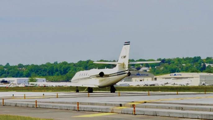
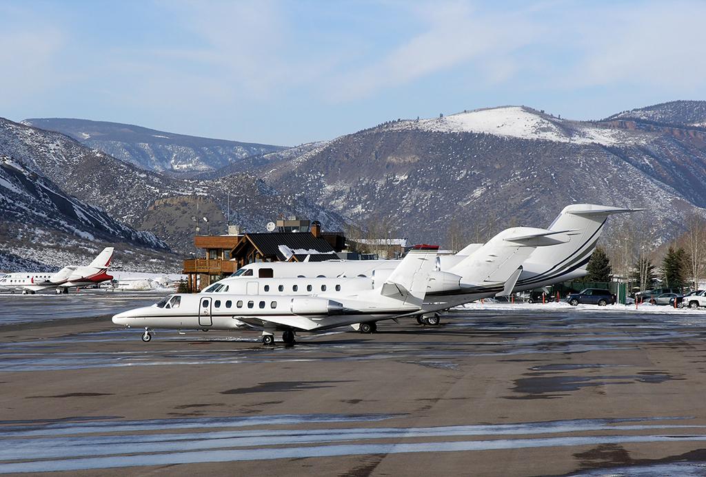
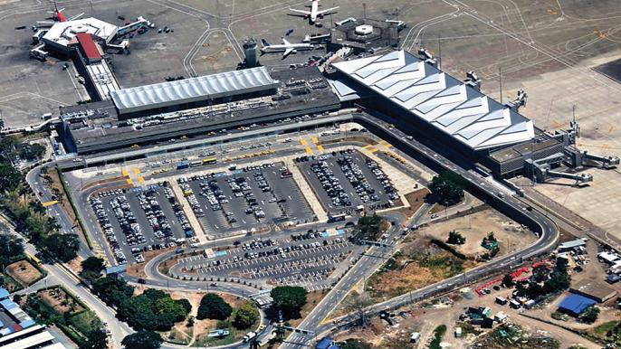
Teterboro (KTEB), New Jersey. Along with White Plains (KHPN), New York; Chicago Executive (KPWK) at Palwaukee, Illinois; Van Nuys (KVNY), California, in the San Fernando Valley just north of Los Angeles; and “Charlie Brown,” or Fulton County (KFTY) , serving Atlanta, Teterboro is synonymous with business aviation.
Located in Bergen County and owned by the Port Authority of New York and New Jersey, Teterboro Airport essentially serves New York City and northern New Jersey as a general aviation airport. A haven for business aviation operators — scheduled airline service is banned from the field — more than 140 aircraft, 116 of which are jets, are based there, and the field is served by four executive-level FBOs. Teterboro has two well-used asphalt runways: 1/19, 7,000 by 150 ft. and 6/24, 6,013 by 150 ft. Both are equipped with arrester beds, one of which stopped a Gulfstream IV that overran the end of Runway 6 on Oct. 1, 2010. Runways 6 and 19 have ILS approaches.
A 24-hr. facility, KTEB averaged 488 movements per day in 2017, so right off the bat, we can see that it’s a busy place, even congested at certain times of the day. Other factors to consider when operating into KTEB include tight airspace, as the airport is wedged in by the controlled airspace of nearby Newark Liberty International, LaGuardia and JFK International airports; at least one complex and potentially hazardous approach involving visual maneuvering around obstacles at low altitude; a nighttime “voluntary” curfew; and a clearly byzantine noise-abatement policy.
Concerning that last item, just like baseball, three violations of KTEB’s mitigation policy within a two-year period — or strikes against you — and you’re out; in this case, banned permanently from operating at the airport. That’s a pretty harsh penalty, but the airport management wants operators to know how seriously it is maintaining its relationship with local residential areas. Runway 24 is the most noise-sensitive, and violations are slapped on operators that exceed the daytime (0700-2200 local) limit of 90 dbA by 1 dbA. Further, there is a nighttime (2300-0600) “voluntary ban” on all “nonessential operations” — in effect, a virtual curfew — and the noise limit for Runway 24 is reduced to 80 dbA. Also, if for any reason Runway 19 is closed (by NOTAM), the noise limit for Runway 24 is raised to 95 dbA for the duration. For current information on Teterboro’s noise policy, go to https://whispertrack.com/airports/KTEB.
Next to consider is KTEB’s congestion and its proximity to LaGuardia (KLGA), only 5 sm to the east. Occasionally, especially when KLGA is landing aircraft on its Runway 13, ATC will institute flow control at KTEB. This results in decimating everyone’s outbound schedule, as engines can’t be started until the conflicting traffic thins out. Thus, monitor the ATIS obsessively. As “Captain Eddie,” BCA contributor James Albright’s alter ego on the code7700.com website, has said of KTEB, “You need to have your act together for this airport.”
While Circling to Land
And that includes the infamous “ILS Runway 6, Circle to Runway 1” approach. The aircraft descends the ILS 6 glideslope and — in VFR conditions and at published circling minima for the aircraft category or higher (at pilot’s discretion) — breaks off the approach, banks right and commences an extended “S” turn to Runway 1. What makes this challenging is the requirement to hook the subsequent left turn so that MetLife Stadium, south of the airport, falls inside the turn, then line up for the approach to Runway 1 — hence, the “S” shape of the maneuver. All this, while staying within the airport traffic area.
Captain Eddie advises that turning inside the stadium’s location (i.e., with the stadium to the right of the aircraft) “makes a stable approach impossible.” Starting the second (left) turn just outside the stadium (with it to your left), “you roll out exactly where you need to be for a stable approach, 1.57 nm from touchdown at 500 ft. above the runway.”
It’s even more demanding when there’s a crosswind from the northwest. “It isn’t the crosswind landing that is particularly dangerous at Teterboro, however,” Captain Eddie warns, “it is the crosswind during the circling maneuver to get from the approach path of one runway to the next that can be particularly challenging. When the winds make the landing on Runway 6 too risky, the same wind can make the final turn onto Runway 1 even more so.”
On the “Teterboro Circling Conundrum” page of the code7700.com site, Albright details how to set up for the circling phase of the approach. Using several computer-generated graphics, he shows the unintended effects of cutting corners resulting in unstable approaches. On both this page and the previously cited one on Teterboro Airport, he consistently emphasizes the importance of the stabilized approach and when to have the aircraft fully configured to land so as not to be distracted at critical points along the circling flight path. This advice, of course, applies to any complex instrument or VFR procedure at any airport.
On May 15, 2017, a Learjet 35A executing the circle-to-land maneuver at Teterboro departed from controlled flight and struck a commercial building approximately one-half nm from the end of Runway 1, killing both pilots aboard the aircraft.
According to the NTSB synopsis of the accident, the crash occurred on the crew’s third flight of the day; the crew demonstrated poor preflight planning and cockpit resource management; failed to properly set navigation equipment for the procedure; had become distracted on the circling approach to Runway 1; “improperly executed the vertical profile of the approach,” crossing fixes “hundreds of feet above the specified altitudes of the approach procedure;” and nevertheless continued the approach, allowing the aircraft’s velocity to drop below the required approach speed, precipitating a stall that caused the crash.
“Collectively, procedural deviations and errors resulted in the flight crew’s lack of situational awareness throughout the flight and approach to [K]TEB,” the NTSB concluded. The lesson: A crew needs to have its act together for ops into Teterboro.
Aspen-Pitkin County/Sardy Field (KASE). Teterboro is a means test for Aspen — maybe. KASE is so risky and has hosted so many accidents one wonders if it should exist at all. “The only way I would have ever gone into Aspen is VFR,” a highly experienced business aviation pilot who ended his career captaining a Gulfstream IV told BCA.
This airport is located in a valley in the Rocky Mountains at an elevation of 7,820 ft. and is surrounded by peaks rising as high as 14,000 ft. Its single runway, oriented 15/33, measures 8,006 ft. in length, is 100 ft. wide and is equipped with R/NAV (GPS), LOC/DME and VOR/DME approaches.
“Aspen is down in a hole,” notes Katha House, a Falcon Jet captain currently working for a charter/management company.
Checking All the Risk Boxes
Richard Arrington, chief pilot for Dillard’s retailers, described Aspen as “the most challenging airport in our system.” KASE “checks all the risk boxes,” he continued: “dangerous terrain, congestion during ski season, complex and dangerous procedures, and rapidly changing weather conditions.”
House concurred: “I’ve had 3.5 years of flying in and out of Aspen twice a week, often in the winter — 132 approaches in all. The weather moves to the mountains and is pushed up quickly. You might have to hold if it’s coming in from the west. We were holding once at FL 220 in a Falcon 50. A Learjet got in, then a commuter, which did a missed approach because of ‘lightning in all quadrants.’ Meanwhile we held for 45 min. to watch the show!”
Her advice: “Wait out the weather — in winter, it flurries in that hole all the time and then moves out quickly. It changes so fast, you can wait [hold] for 5 min. and it will change.
“Start your approach at 16,000 ft.,” she continued, “then cross the Red Table VOR, descend to 13,000 ft., and then ‘drive’ down [descend] 5,000 ft. at Ref+10. Be fully configured for landing at Red Table VOR. There are mountains all around. I shoot two approaches and then, if it still doesn’t look right, I go to the alternate. No second guessing at this field.”
Indeed. Arrington said he can recall three accidents at Aspen that influenced the operations of his flight department. “In 2001, a Gulfstream III crashed into the bluff just to the right of the final approach course. I remember passing the debris and scorch marks not long after. That was the first time I could so clearly see a fatal accident site from the cockpit. In 2012, I was parked on the ramp waiting for passengers when a Learjet landed, and inexplicably, to me, just veered off the side of the runway. I had never witnessed, first hand, an accident right in front of me. In 2014, I was instructed to hold just after a Challenger exploded into a ball of fire on the runway. My passengers saw it from the [FBO] lobby.”
The controllers at Aspen-Pitkin County do an “excellent job,” Arrington said. “It is a high-risk airport, and I tell all my guys, no matter how well-informed you are, you are surely not alarmed enough.”
Chicago Executive Airport (KPWK) is one of the Windy City’s oldest and most popular business aviation airports. Opened in 1925 and named Palwaukee for the intersection of Palatine Road and Milwaukee Avenue in Chicago suburb Wheeling, the airport has been associated with the Priester family since 1953, when George Priester bought the field and developed it, adding paved runways, hangars and other infrastructure.
Over the years, his son Charlie founded FBO, charter and aircraft management service Priester Aviation and, in 1986, negotiated the sale of the airport, now Chicago Executive, to Wheeling and Prospect Heights. In 2001, Charlie sold the FBO to Signature Flight Support and three years later turned leadership of Priester Aviation over to his son Andy, marking three generations involved in the operation.
At an elevation of 684 ft., the airport his three runways: 16/34, 5,001 by 150 ft.; 12/30, 4,415 by 75 ft.; and 6/24, 3,677 by 50 ft. The airport chalks up close to 80,000 movements a year distributed between FAR Part 91 and 135 operations. In 2017, 194 aircraft were based there, 62 of them jets. In addition to Signature, Atlantic Aviation and Hawthorne Global Aviation Services operate FBOs on the field.
Like many older airports in U.S. metro areas, Chicago Executive is tightly enclosed by surrounding residential and business communities and by controlled airspace of a larger international commercial airport, in this case, O’Hare (KORD), the nation’s busiest airdrome, equipped with eight constantly busy runways. This comes into play mostly on departures from KPWK’s longest and widest runway, 16/34, accessed by most jets. “On the instrument departure,” retired business aviation captain/av manager and BCA contributor Ross Detwiler explained, “you do a hard-right climbing turn within 1 nm to avoid O’Hare International’s Runway 4/22, completing the turn to the assigned heading north of the 058 radial out of the DuPage (DPA) VOR while maintaining 3,000 ft. or the assigned altitude.
It Comes Up Fast
“Let’s say it’s a GIV,” Detwiler continued. “You lift off, begin the turn within 1 nm — which you can miss in the blink of an eye. So you’re busy and heavy with fuel. You have to pull the power back, too, to maintain the Class B speed of either 200 or 250 kt. [depending on whether you’re in or below the Class B airspace].”
For the visual departure (which most jets won’t fly), he advises, “Make the climbing turn to the northwest, maintain 2,400 ft. to remain below the 3,000-ft. floor of Class B airspace overlaying Chicago; max airspeed there is 200 kt.” Meanwhile, the approach to Runway 16 has high minimums, a 284-ft. DH.
Years ago, Runway 16/34’s width was a narrow 75 ft., allowing little latitude for error on takeoffs and especially landings. “Once you got down and stopped, then you had extremely narrow taxiways, and really crowded ramps — too many airplanes parked in too little space,” Detwiler reminisced. Since then, 16/34 has been widened to its present 150 ft. But parking is still at a premium, “so call ahead and try to reserve a space,” he advised. “It’s so crowded we often had to be marshaled off the ramp. There’s now a new FBO area on the east side of the airport that should make it easier.”
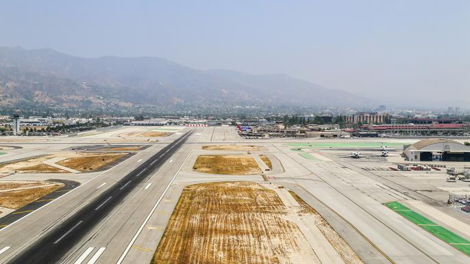
Burbank Bob Hope Airport (KBUR), nee Glendale-Pasadena-Burbank Airport, nee Hollywood-Burbank Airport, nee Lockheed Air Terminal, is a Southern California icon. It was, for a period in the 1930s, the company airport for Lockheed Aircraft, and before that, dating from 1930, the Los Angeles-area’s terminus for the United Aircraft & Transport Co., owned by Boeing Aircraft and United Airlines, which founded the airport.
Today, Burbank is a major regional airport in the Los Angeles megalopolis, accessed by airlines and business aviation alike. In the 90 years since the airport was founded, however, it has been encompassed by both residential and industrial development with no buffers between its operating area and perimeter fences. (For decades, it was the site of Lockheed Aircraft’s main factory and headquarters. It was here that the P-38 and F-80 fighters and Constellation airliners were built.) Furthermore, its two runways, originally surveyed to accommodate piston-engine airliners, are relatively short, allowing no slack for overruns: 15/33, 5,886 by 150 ft. and 8/26, 5,801 by 150 ft. Runway 8, which is often favored by the local wind patterns, tends to get a lot of action.
In March 2000, a Southwest Airlines Boeing 737 overran Runway 8, crashed through a thrust diverter, then the perimeter fence, and wound up on Hollywood Way with its nose protruding into a gasoline station. Luckily, no one was hurt, but a few more feet and a disaster could have ensued. The Southwest cockpit crew paid for their faux pas with their jobs. After that one, engineered materials arrestor system beds were installed at the end of Runway 8, which successfully stopped a Gulfstream IV overrun in October 2006 and another Southwest 737 on a rainy morning in December 2018. In both cases, no injuries were reported.
“It’s so tight, there’s no place to go,” Detwiler noted. “Generally, they land you on Runway 8, but what gets dicey is if you have to do the missed approach, as you have to head toward the [San Gabriel] mountains. You climb to 1,800 ft. and bend it around in a right turn to miss the terrain, rising to 4,000 ft. above the San Fernando Valley and 10,000 ft. farther east at Mount Baldy.
“If you land on 8,” he continued, “you’re right at the terminal when you roll out, and there is no taxiway, just a line painted on the ramp. You have to make a left turn to get away from the ramp, and that takes you to Taxiway D. Now you’re going west and have to hold short of Runway 15/33; cross that, and then make your way to the FBO. It’s very busy, so stay alert.” Good advice, at Burbank or anywhere eIse.
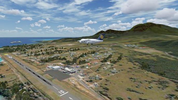
Nevis Island Vance W. Amory International Airport (TKPN). Heading down Caribbean-way, this field on the tiny island of Nevis might be in the destination box of your flight plan if your principal wants to spend some time at the Four Seasons Hotel there. Nevis and its nearby neighbor, St. Kitts, are members of the leeward chain of the Lesser Antilles, which form the eastern boundary of the Caribbean Sea. Together, the two islands constitute one country, the Federation of St. Kitts and Nevis. (The scores of other islands, islets and cays in the chain are divided between the U.S. and British Virgin Islands.)
Nevis is of historical significance to Americans as the birthplace of Alexander Hamilton, one of the republic’s founders and first secretary of the Treasury, and to the British as the birthplace of naval hero Horatio Nelson.
Vance W. Amory International Airport has one runway, 10/28, 3,996 by 98 ft. with a displaced threshold landing to the west. Elevation of the airport is 25 ft. and the runway is at 13 ft. “It’s right on the edge of the water with higher terrain to the south,” reports House, who’s operated into the field. “A Global crashed there some time ago by dragging a wing.” Jeppesen notes on the approach plate specify “Hurricane Hill with 273-ft. hazard light is located 4,800 ft. west of displaced threshold.” Bone up on the airport and its obstacles before going there the first time.
Cali Alfonso Bonilla Aragon International Airport (SKCL) is located in Palmira, 12 sm or about a 20-min. drive from Cali, Colombia. Its elevation is 3,162 ft., and its sole runway, 1/19, is paved in concrete and measures 9,842 by 148 ft. On the ground, arriving aircraft are directed to a dedicated general aviation ramp for parking, and crew and passengers are bused to the airline terminal for CIQ. Security at the airport is rated as high.
When considering operations in Colombia, it is important to note that the country’s interior is characterized by a series of north-south mountain ranges. Furrowed into them are two main valleys where the country’s capital, Bogota, and third largest city, Cali, are located. Going into either, “you have to be extremely careful,” a business aviation pilot with considerable experience in the country warned. “The terrain is always in the back of your mind. Ground ‘prox’ [radar] is a wonderful lifesaver.”
The long north-south valley containing Cali International, he notes, “starts to constrict as you go in. Watch for the rising terrain, as it’s a fairly tight canyon.” The valley is not a complete box, but turning to the east, the Andes “really go up high. Spatial orientation is really critical; use your modern cockpit aids,” he advises.
Straight-Ins Not Advised
The terrain on either side of the valley varies between 15,000 and 17,000 ft., and given the field elevation at Aragon International, a lot of altitude has to be lost in a short time and distance going in. A straight-in approach is not advised. Instead, operators advise to fly a procedure turn, crossing over the VOR at the airport southbound, then come back in to lose the altitude and line up. Remember that no matter what vectors ATC assigns, the flight crew is still responsible for knowing where dangerous terrain is located.
One cannot speak of Colombia and aviation in the same sentence without remembering the December 1995 crash of an American Airlines Boeing 757 into a mountaintop on approach to Cali in which only four occupants of 163 people on board survived. While several factors contributed to the nighttime mishap, the principal one was confusion and spatial disorientation on the part of the crew. The accident stands today as an iconic statement of the perils implicit in operating jet aircraft in and out of airports situated in mountainous terrain like the Andes of South America.
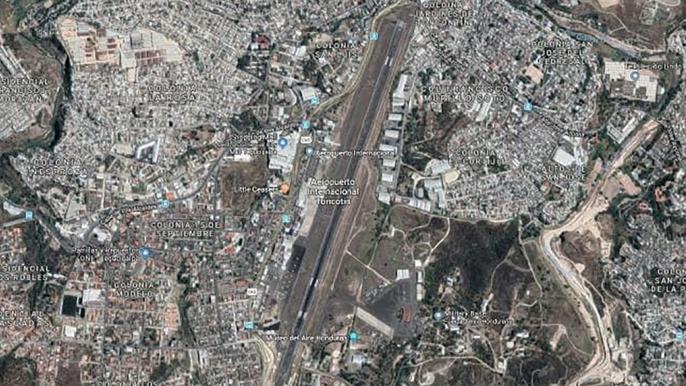
Tegucigalpa Toncontin International Airport (MHTG), serving the ancient capital of Honduras, lies high in the mountains of this Central American country. While Tegucigalpa is the most popular destination in Honduras, its Toncontin International Airport has ranked among the most dangerous airports in the world for jet aircraft due to its relatively short Runway 2/20, the fact that the city is built right up to the perimeter fences, and short final to one end of the runway took aircraft dangerously close to the top of a hill.
(The airport features in one of the most-viewed postings on YouTube, depicting an American Airlines Boeing 757 bent over in a steep-banked left turn from base to final approach, practically scraping the crest of the hill as sightseers throw themselves to the ground and the Boeing plummets to Runway 2/20 below. It slams onto the asphalt with clouds of rubber smoke emanating from the tires, the engines immediately engaging full reverse thrust, then rolls all the way to the end of the runway. It’s just another day at MHTG.)
Since 2007, however, part of the hilltop has been shaved, making the Runway 2 approach, which favors prevailing winds, a less nail-biting affair. Nevertheless, in 2008, a TACA Airbus A320 overran the runway, plunging down a 65-ft. embankment, breaking up and killing eight aboard.
The single strip measures 6,631 ft. by 148 ft. — with only 5,459 ft. usable for the Runway 2 approach to accommodate even the lowered hilltop. Making things more interesting is the fact that field elevation is 3,297 ft., and the city is surrounded by mountains. (In 2011, a Lot-410 Turbolet operated by Central American Airways went down 12 mi. from the airport while on approach in high terrain, killing all 14 aboard.) Only a VOR-DME approach is available.
There is no FBO at Toncontin. Crew and passengers are escorted by customs personnel to a passenger terminal to clear; handlers are permitted to accompany to help expedite the process. Fuel is readily available at good prices. For ground transportation, it is recommended to use only prepaid taxis. In addition to being the second poorest country in the Americas (behind Haiti), Honduras is also one of the most dangerous — on the streets as well as operating into its capital’s airport.
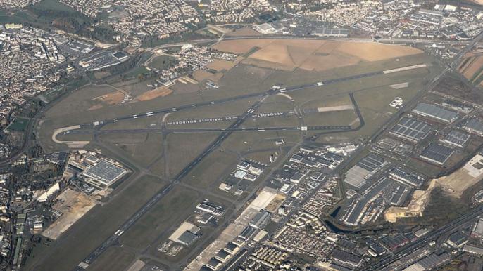
Paris Le Bourget Airport (LFPB). As BCA reported in our September 2019 issue, Paris Le Bourget ranks as Europe’s premier airport exclusively dedicated to business aviation — except for one month in odd-numbered years when it hosts the Paris Airshow, and the rest of aviation shows up from around the world. So if you’re going to Europe to conduct business, chances are you’ll be visiting Le Bourget.
LFPB is a modern and well-equipped airport with three runways, the latest navaids and clean approaches. It is in no way dangerous, like a few of the other facilities noted in this report, but its airspace is congested and overlaid by traffic corridors serving nearby Charles De Gaulle International Airport (LCDG) and, thus, can be challenging, especially to first-time visitors. In 2017, it recorded 53,686 movements, the highest for a business aviation airport in Europe, and essentially all were turbine-powered, as light piston-engine aircraft are diverted to small general aviation airports ringing Paris.
Le Bourget is a 24-hr. airport with no slot control, a luxury in busy Western European cities. Field elevation is 218 ft. and the aforementioned runways are: 3/21, 8,743 ft. by 197 ft., asphalt; 7/25, 9,843 ft. by 148 ft., concrete (middle 5,774 ft. grooved); and 9/27, 6,053 ft. by 148 ft., asphalt.
Navaids include ILSes for Runways 7/25 and 9/27 and a VOR-DME located on the field. Approach and departure control for La Bourget is handled by LCDG, whose controlled airspace overlays the smaller airport. Flight crews approaching Le Bourget should be constantly aware that they are entering some of the most congested airspace in Europe. Pilots interviewed by BCA universally stressed the importance of understanding the proximity of LCDG and the “do not overfly” zone to the south of its south runway complex — and furthermore, that Le Bourget’s Runway 7 missed approach demands good crew situational awareness.
No Sightseeing!
And another point relevant to situational awareness: In clear weather, curb the sightseeing! That is, whether you arrive or depart at night or during the daytime, Paris will be laid out below like a (visually distracting) carpet of jewels, so keep your eyes in the cockpit and pay attention to the procedure you’re flying.
At 200 nm out, the crew should inquire about the arrival to be expected by ATC. As one captain observed, “If you don’t, they will either assume you know — bad idea — or will issue the arrival right before the initial arrival fix.” On the other hand, approach control has been known to change things at the last minute, or in the middle of one arrival, switching to another, so keep your knees bent and be ready to accommodate changes.
Coming in, Charles de Gaulle Radar is the initial approach control and arrivals are straightforward. Landing to the east, expect ILS Runway 7 with vectors to final. Landing to the west, Runway 27 is preferred, again generally, with the ILS approach. In both cases, RNAV (GNSS) approaches are available on request.
Flight crews new to Le Bourget or returning after long absences are urged to consult the French State Rules and Procedures as part of their preflight planning. And as most, it is important to always use standard ICAO phraseology on the comm and avoid using U.S. ATC slang.
On the ground, things can get complicated, too: There are seven FBOs at Le Bourget — certainly the most of any airport in Europe — and four repair stations, three of which are aircraft type service centers. Thus, it’s a good idea beforehand to coordinate with your handling agency exactly where you want to go on the ramp to be prepared when ground control asks for your parking destination.
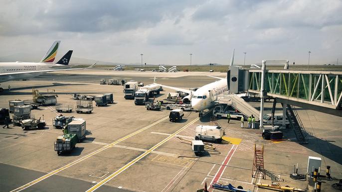
Addis Ababa Bole International Airport (HAAB) serves Ethiopia’s capital and is so named for the Bole neighborhood in which it is situated 3.7 sm southeast of the city center. It is a modern field equipped with parallel asphalt runways: 7L/25R, 12,467 ft., and 7R/25L, 12,139 ft. Both are 148 ft. wide and 7R/25L is equipped with an ILS.
What flight crews should keep in mind, according to a Gulfstream 650 captain with extensive international experience, is that Bole is “a high-elevation airport, with a lot of mountainous terrain around it, and therefore a CFIT risk. Often, you will be operating at high weights due to the fuel load to get back to, for example, Europe — so that equates to high weight, high temperatures, and performance limits, especially on takeoff.”
The captain described a recent visit to Addis Ababa from a European departure point, starting with route planning through a “politically sensitive” region. “We didn’t want to overfly Sudan or Libya, so our choices were to go west and south of Sudan or through Egypt,” he recounted. “As we looked at it, it appeared that the Egypt and Saudi Arabian routing presented better options for alternates.”
Loss-of-Separation Issue
On that trip, coming in from the east, the captain reported, the flight passed a waypoint on the Djibouti FIR where on previous trips there had been a loss of separation by Djibouti ATC, “so you had to maintain your own separation,” he continued. “On the same trip, we were in their airspace and they handed us off to Addis Ababa control, and there didn’t seem to be good coordination. Those kinds of issues . . . we see that frequently in Africa.”
The message is to expect such lapses in the region and to be vigilant at all times, even broadcasting the aircraft’s position on the African guard channel. (Farther south in Central Africa, it is possible to fly for hours without any contact with ATC, so aircraft often radio their positions to each other, maintaining their own separation.)
Then, in Ethiopian airspace, “they gave us a late descent. On the ILS for 25 Left, there are three fixes where the speed limit is 185 kt.” The challenge is to maintain them after what the pilot termed “a slam-dunk descent” from cruising altitude. Until recently, one of the two parallels at Bole was closed and temporarily used as a taxiway. “During daytime operations, you had to make sure to align with the correct runway. Both runways are open now, but still use care that you’re headed for the assigned one,” he cautioned.
As noted, there is very high terrain around the airport. Field elevation is 7,625 ft., MSA is 14,000 ft. and the highest terrain, just north of the approach track, is 10,500 ft. Thus, constant situational awareness is essential.
Johannesburg-Lanseria, South Africa (FALA) is yet another field sited near high terrain. The airport is relatively young, having been founded by two private pilot/owners in 1972 as a grass strip. Local municipalities purchased it the same year, converting the field into a commercial airport with a paved runway and bringing in airline service. In 2012, the field was again sold, this time to a consortium of South African public support organizations.
Field elevation at Lanseria is 4,521 ft., which, combined with southern hemisphere summertime temperatures, can result in performance issues. Fortunately, FALA’s single Runway 7/25 is 9,996 ft. long to accommodate those conditions. And while the strip is 148 ft. wide, according to one pilot who’s been there recently, it appears — for some unexplained optical reason — to be narrower than that. It’s fine for large business jets, but in the pilot’s words, “you have an increased ‘pucker factor.’” Further, the runway has a 1.5% gradient, sloping toward its southwest end; due to prevailing winds from the north, the preferred approach is to Runway 7.
Additionally, first-time visitors should be aware that there is high terrain 5.5 sm west of the airport, and so noted on the airport chart. “So, good situational awareness is necessary,” the pilot opined.
But interestingly, the real challenge at Lanseria is the main ramp. “If you come in internationally,” the pilot said, “you have to park on the main airline ramp for CIQ clearance, and it is steeply sloped. So you have to taxi uphill, and there is a risk of the aircraft rolling back once you stop. Then you have to leave the aircraft to go inside to clear immigration, so always leave one crewmember in the cockpit — do not leave the aircraft unattended.” Also, use parking brakes and chocks “judiciously.”
After CIQ clearance, the obstacle course continues: “You reposition to the ExecuJet FBO, but the taxiway is narrow, and there is a security gate that they will open, but make sure you are on the centerline of the taxiway and have wing walkers if you are operating a large aircraft like a G650.”
Pago Pago International Airport (NSTU), American Samoa. OK, we were assigned to describe 10 challenging airports, but here’s a bonus point: a South Pacific island airport that international operators may visit, either as a destination or tech stop. Pago Pago (pronounced “Pango”) — known as Tafuna Airport to locals — dates from World War II, when it was built to accommodate Marine fighter and torpedo-bombing squadrons. Today, it hosts two runways, 5/23, 10,000 by 150 ft., and 8/26, 3,800 by 100 ft., both asphalt, and is served by several airlines and often accessed by the U.S. military.
As House describes it, the long runway is distinguished by its 32-ft. elevation, “so that when wind blows out of the south in the spring — the southerlies — it picks up spray and casts it across the runway. It rolls on and it rolls off, and now you see it [the runway] and now you don’t.
“So, be aware of that,” she warned. “It’s like landing in the rain — you follow the localizer in and land. You’ll get spray on one side of the aircraft and nothing on the other.” All in a day’s work for the typical international business aviation flight crew, which has to take these things as par for the course.
OK, these 11 choices of challenging airports were ours plus recommendations from a brain trust of international pilots we often tap for information and opinions. Readers are invited to submit their choices, reasons and personal experiences, too. We’ll publish them in future issues, or on our website, or if there’s enough interest, organize them into a subsequent report.
And here’s a further tip we forgot to mention earlier: Sometimes the best authority on a challenging airport you haven’t visited is someone who’s been there and knows the issues. So use your contacts and resources like the NBAA International Feedback Database, Ops Group and pilots who might be based at the airport for which you’re headed.

Related Content


Comments