In their westward migration from Norway more than 1,000 years ago, the seafaring Vikings navigated their longboats across the treacherous North Atlantic all the way to today’s Eastern Canada. Along the way, they settled numerous islands isolated by thousands of square kilometers of ocean, the largest of which was a volcanic pile they initially called Snaeland (“Snow Land”), then later renamed Iceland for the icebergs that clogged a prominent fjord.
According to ancient records, the first permanent settler on the island was Norwegian chieftain Ingolfr Arnarson, who arrived in 874, although archeological digs have revealed that he may have been preceded by Irish monks called the “Papar.” Despite its location (66 deg., 37 min. north) brushing the Arctic Circle — and its reputation and name —Iceland sits in the path of the Gulf Stream’s relatively warm water that provides it with a somewhat temperate climate (and keeps Western Europe from emulating Siberia). As a result, the misnamed island’s eastern side actually greens up in the northern summer, which ultimately attracted immigrants from Scandinavia, principally Norway and Sweden.
By 930, Iceland had become a commonwealth governed by the Althing, one of the oldest legislative assemblies on the planet, but infighting among tribes in the 13th century resulted in an accession of rule by Norway. This lasted until 1397 and the formation of the Kalmar Union among Norway, Sweden and Denmark, which brought Iceland along for the ride. When the Union broke up a century later, Iceland reverted to the Norway/Denmark joint kingdom but was dominated by the latter country, which also claimed possession of Greenland.
The 17th and 18th centuries were not kind to Iceland, as Denmark imposed harsh trade limitations on the island, which were compounded by natural disasters — including volcanic eruptions and epidemics of smallpox and other diseases, famines and raids on coastal settlements by pirates. Following the Napoleonic Wars in 1814, the Norway/Denmark alliance was broken, and Denmark assumed full possession of Iceland. In the mid-19th century, an independence movement began to gel in Iceland, inspired by nationalistic ideas in Europe and Danish intellectuals living in Iceland. In 1874, Denmark granted Iceland a constitution and limited home rule, which was expanded in 1904. Then, in 1918, the Danish-Iceland Act of Union was signed in which Denmark recognized Iceland as a fully sovereign and independent state in a union similar to that of the British U.K. But the Act of Union had a 25-year limit, expiring in 1943. The following year, a plebiscite was held in which Icelanders voted overwhelmingly to end the union with Denmark and establish a republic, and on June 17, 1944, Iceland became a constitutional republic with Sveinn Bjornsson as its first president.
An Aviation Heritage
This small (39,682-sq.-mi.) country played a strategic role during World War II as a base for the air defense of the ship convoys that daily crossed the North Atlantic from America and Canada, bringing essential supplies to Great Britain and Russia for the war effort and, after the U.S. entered the war, troops for the impending invasion of Europe. It also served as a refueling stop for aircraft making transatlantic crossings in both directions.
The British Royal Air Force based Hawker Hurricane fighters at Reykjavik Airport (dubbed RAF Reykjavik for the duration of the war), while the U.S. Army Air Force built two airfields near the town of Keflavik that were merged after the war to eventually become Keflavik International Airport, today Iceland’s principal airdrome. And, significantly, the remnants of the Norwegian Air Force, after fighting a heroic but ultimately futile defense against the invading Nazi German Luftwaffe, retreated to Iceland, remaining there to fly convoy defense for the remainder of the war.
Although Iceland does not maintain an army, it nevertheless became a member of NATO in 1949, a move not without controversy among its citizens, many who believed that a small, vulnerable island in the North Atlantic should maintain neutrality. During World War II, the U.S. undertook the defense of the island, then departed after the German surrender in 1945. However, as the Cold War era began, the two nations entered a defense pact in 1951, and the American military returned to the island, maintaining a presence there until 2006.
Aviation has played a significant role in Icelandic culture and business since the early 20th century, acting as a counterpoint to the isolation of the island by being able to connect it to numerous destinations in Europe and North America within a matter of hours. Its mid-Atlantic location also worked in Iceland’s favor as a refueling stop for early transoceanic airline flights and, later, when range-limited first-generation business jets began transits between Europe and North America in the 1960s.
Iceland also spawned two indigenous international commercial carriers, Icelandair in 1937 and Icelandic Airlines in 1944, the latter famously introducing low-cost or “economy” fares for transatlantic flights favored by college-age travelers in the 1960s (lending it the sobriquet “the Hippie Airline”). The two airlines were merged in the mid-1970s, continuing operations as Icelandair, which today operates a fleet of legacy Boeing 737s, 757s and 767s to international destinations. (It was in the process of accepting new 737 MAX jetliners — and had several in operation — when the type was grounded in 2019. The five MAXs delivered, out of a total order of 11, were in storage as this was written. Also on order are Boeing 787s.)
Major Player in Oceanic ATC
Iceland’s geographical location also has lent it a major role in North Atlantic oceanic air traffic control. The country’s privatized ATC provider, ISAVIA, manages a huge parcel of airspace in the upper latitudes as one of the seven member states vested by the International Civil Aviation Organization’s (ICAO) North Atlantic Systems Planning Group (NATSPG) with provision of ATC services in the North Atlantic, the others being the U.S., Canada, the U.K., Denmark, Norway and Portugal (through the Azores). Transatlantic operators who may never go to Iceland as a destination or tech stop will often be worked by ISAVIA (and pay their considerable nav fees) as they overfly the island.

Overflights, in fact, have lately accounted for a considerable amount of activity in Iceland’s oceanic airspace — or did before the coronavirus pandemic. Ultra-long-range airliners like the Boeing 777-300ER (7,300 nm) and business jets like the Gulfstream 650 (6,997 nm), Bombardier Global 6500 (6,150 nm) and Dassault Falcon 8X (6,450 nm), capable of operating nonstop between the West Coast of North America and Central Europe, are flying great-circle routes that take them through Icelandic airspace and, often, right over the island. “The airspace up there has really changed the NAT traffic flow,” Mitch Launius, president of 30West International Procedures Training, pointed out. “The Icelanders play a significant role in the NAT meetings because so many people overfly them, and they manage so many airplanes. So, they have a lot of responsibilities and have high technical and skill levels to meet them. They are key players in that region.”
The importance of that role is evidenced by the 23-year service of ISAVIA chief Asgeir Palsson as NATSPG chairman. So admired was Palsson that when he completed his term in 2019, NATSPG members conferred on him an “honorary chairman” title. It is also noteworthy that Palsson’s successor — elected by the other NATSPG members — is Hlin Holm, head of the Air Navigation Services Section, Icelandic Transport Authority.

FAA and Icelandic ISAVIAThis traffic plus a portion of the Blue Spruce published routes and the North Atlantic Track System (NATS) — when seasonal conditions move it that far north into Iceland’s airspace to take advantage of more favorable winds — is managed by the Reykjavik Area Control Center (RACC) in Iceland’s capital city. The Center also serves as the terminal control area (or TRACON) for Reykjavik and Keflavik Airports. Its terminal maneuvering area (TMA) is effective to 24,500 ft. within a horizontal radius of 40 nm from Keflavik Airport.
At 2.085 million sq. mi. (5.4 million sq. km), the Reykjavik Oceanic Control Area (OCA) is one of the planet’s largest FIRs. It extends from the prime meridian to 76 deg. west, just west of Greenland and abutting the Gander OCA, and from 61 deg. north latitude, just south of the Faroe Islands and bordering the Shanwick OCA, to 90 deg. north, the geographical north pole. To the east, it adjoins the Norwegian-controlled Bodo and Stavanger OCAs and the Russian-controlled Murmansk OCA. Reykjavik also provides terminal control for Sonderstrom and Thule Airports in Greenland (the southern tip of Greenland south of 61 deg. north falls under Gander OCA) and Vagar Airport in the Faroes.
Before the COVID-19 pandemic, more than 25% of North Atlantic air traffic passed through the Reykjavik OCA. According to ISAVIA statistics, in 2018, total traffic in the Reykjavik OCA amounted to 196,001 transits, 7,067 by general aviation aircraft, most likely business jets. In 2019, total traffic was down by 7.5%, while general aviation had increased to 7,233 movements. For comparison, totals for the year 2010 were, respectively, 102,275 and 6,049. Of course, with the coronavirus pandemic eviscerating commercial air travel in 2020, total transits through Reykjavik-controlled airspace are expected to tally far lower than in recent years.
For a small country with limited resources to not only be handling high traffic loads like this but investing in considerable cutting-edge ground infrastructure to support it, ISAVIA consequently charges fairly high navigation fees. This has often been an issue for private operators accessing its OCA, as well as Iceland’s airports, which are also operated by ISAVIA. Perhaps some compensation can be found in what Craig Mariacci, vice president of sales at Skyplan in Calgary, Canada, terms “some of the cheapest fuel prices on the planet” at Reykjavik airports, clearly an incentive for encouraging operators to plan tech stops on the island.
Commitment to ADS-B
This oceanic airspace is unique in that the south and east sectors (constituting about half of it) are covered by radar surveillance from seven stations spread among locations in Iceland, the Shetland Islands and the Faroe Islands. Thus, control in those sectors is similar to that in most domestic airspace, while in the north and west sectors, procedural control is the norm.

Now, add ADS-B to the radar network, and you have an enhanced level of precision in oceanic control. This owes its origins to a commitment some years ago by Nav Canada to install a string of ADS-B ground stations across northern Canada and through the Maritime Provinces in lieu of conventional surveillance radar and its implicit cost and maintenance requirements. Subsequently, Nav Canada partnered with ISAVIA to implant 10 more stations across Greenland — and in parallel with those, installation of VHF comm transceivers. Further, in Iceland, eight ADS-B stations are under construction on mountaintops, ensuring a reception range of at least 250 nm from land, with four additional stations planned in the Faroe Islands. All of this revolutionizes oceanic operations in this region by enabling actual surveillance of en route flights as opposed to procedural control.
Consequently, within Iceland’s OCA, ISAVIA has created a block of “ATS Surveillance Airspace” overlaying Iceland and beginning above 19,500 ft. over Greenland to take advantage of this technology. (While Greenland controls its own airspace up to 19,500 ft., above that, the airspace is delegated to Reykjavik; as noted, Gander controls the southern tip of Greenland.) According to NATSPG, Ops Bulletin 2017_001_Rv. 04, July 9, 2019, airspace not encompassed in the North Atlantic Data Link Mandate (DLM) includes that “where an ATS surveillance service is provided by means of radar, multilateration and/or ADS-B, coupled with VHF voice communications.” (This assumes that the aircraft is “suitably equipped,” i.e., with a transponder and ADS-B avionics.)
And this opens up North Atlantic transits to domestically equipped aircraft. Launius points out that controller-pilot data-link communication (CPDLC) is not required when transiting this block of airspace: “It is ‘data-link exemption airspace,’ allowing you to operate without FANS 1/A [i.e., ADS-C] and which is handled much like domestic airspace with VHF comm.”
Meanwhile, operations on the Blue Spruce fixed routes can be carried out with one long-range nav set and no HF radio — with some exceptions. But they do require a Letter of Authorization and an FAA review; however, if the operator is already approved for NAT oceanic ops, that nod also covers the Blue Spruce routes. The Blue Spruce routes can also serve as a backup for a fully equipped jet if it were to lose its HF capability before entering oceanic airspace. The same goes for failure of one of the two required long-range nav systems. (The aircraft would have to re-file if unable to pass an HF operational check or lose the nav set before entering oceanic airspace.)
Operating Into Iceland
So far, we’ve considered Iceland and its airspace in respect to overflights. As a destination or a tech stop, operators will find the island friendly and accommodating. Because Iceland is a party to the Shengen Agreement, U.S., Canadian and EU citizens can enter the country and remain for 90 days without visas. “We would recommend at least three months validity on passports,” Marek Siwiak, an international trip support manager at ARINC/Collins Aerospace, said. “Check the Icelandic immigration website for other nationalities’ requirements.”

Permits are, likewise, “wide open,” Siwiak continued, meaning none are required for FAR Part 91 operations. “Most of our clients use Keflavik as a tech stop, and a permit is not required since no one will be disembarking.” However, he cautioned, “If going in as a charter under Part 135, a permit is required thru ICETRA [Icelandic Transportation Authority]. The charter permit is easy to get, with only three business days lead time.” And as Skyplan’s Mariacci pointed out, no permits are required for Icelandic overflights.
Customs clearance is also straightforward. “No APIS required,” Siwiak said. “They will ask for a copy of the GenDec, that’s all. You clear on the aircraft or an FBO, and then you’re on your way. But don’t show up without a passport.” Mariacci advised that operators should be prepared for occasional European-style ramp safety inspections at Icelandic airports.
Iceland is WGS 84-compliant and altimetry is measured in QNH. ICAO Pans Ops apply, as they do in oceanic airspace and European airspace.
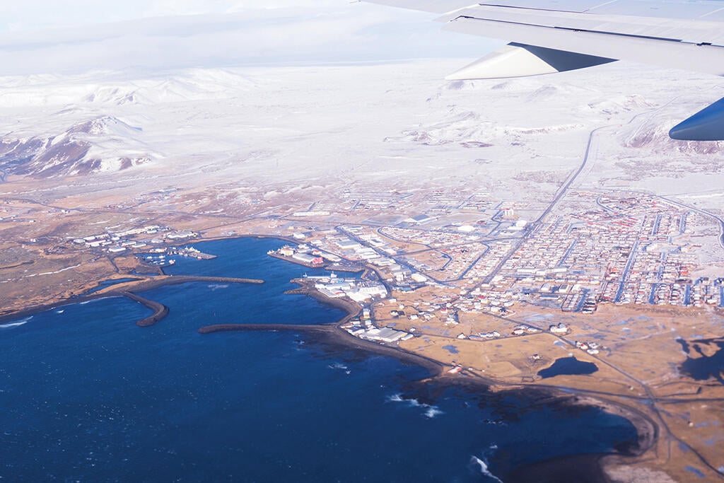
There are four designated international airports on the island. Reykjavik (BIRK) and Keflavik (BIKF) both serve Reykjavik, Iceland’s capital and largest city, located on a peninsula jutting into the ocean on the west end of the island. The other two are much smaller regional airports, Egilsstadir (BIEG) near Iceland’s far eastern coast and Akureyri (BIAR) on the edge of a north coast fjord.
Almost all international traffic entering Reykjavik domestic airspace goes to Keflavik International Airport. It is a modern, well-equipped field located 31 sm (50 km) southwest of Reykjavik, about a 25-min. drive to the city on good roads. A 24-hr. airport, BIKF has two asphalt runways with clear approaches: Runway 1/19, 10,020 ft. in length, and Runway 10/28, 10,056 ft. Both are 200 ft. wide and equipped with ILSes. Field elevation is 171 ft.
Slots are required at BIKF, which can be requested online by a service provider or the operator. According to Cameron Moore, also an international trip support manager at ARINC/Collins Aerospace, “There is a quick response on the web.” Reportedly, no slots are required at any other Iceland airport for general aviation. Moore also pointed out that noise abatement procedures apply at Keflavik, but “they are not as stringent as European airports.” Operators are referred to the Icelandic Aviation Information Publication (AIP) for further information.
Reykjavik Airport (BIRK) is the domestic field for the city, hosting intra-Iceland airline flights, a few international charters, flights to and from Greenland, transatlantic aircraft ferry flights and some business aviation activity. Located only 1.2 sm (2 km) from Reykjavik’s business center, it was Iceland’s original airport, a dirt field until the advent of World War II when the British RAF established its base there and paved over the runways. Because it sits within the city limits, a night curfew has been imposed on BIRK between 2300 and 0700 weekdays and 2300 to 0800 on weekends. BIRK also has two active asphalt runways: Runway 1/19, 5,840 ft. long by 147 ft. wide, and Runway 6/24, 3,150 ft. by 98 ft. A third strip, Runway 13/31, 4,034 ft. by 147 ft., is closed as of this writing. Runway 19 is equipped with an ILS. Field elevation is 44 ft.
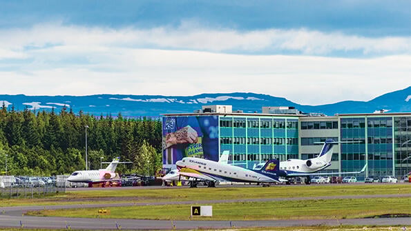
The two main airports are somewhat unusual for a country that identifies mostly with Europe in that both host multiple FBOs servicing business aviation. IGS Ground Services and ACE FBO have facilities at both airports, with SouthAir also at BIKF. All maintain passenger lounges and flight planning centers. Each provides fueling and claims quick turnarounds for tech stops. Other services such as deicing, hotel reservations, ground transportation and catering are available. Parking is claimed to be generous on FBO ramps and reservations are generally not necessary. Very large aircraft such as BBJs and Airbus AC319s are easily accommodated on the airports but not always on FBO ramps. Security is claimed not to be an issue: “All airports are fenced,” Moore said, “and if you need it for the aircraft, it can be arranged.”
The two other Icelandic international airports are worthy of consideration for domestic travel within the country or as alternates in case of contingencies. “For a divert or ETP,” ARINC/Collins’ Siwiak told BCA, “these two fields can be opened within 30 min., depending on the season.” Egilsstadir, near the town of the same name, connects the Icelandic east coast with Reykjavik and provides some airline flights to Copenhagen, London and Edinburg. It has a single asphalt runway: 4/22, 6,562 ft. in length and equipped with an ILS. Its elevation is 75 ft.
Volcanic Reliever
Up north, Akureyri Airport, which sits on the delta of the Eyjafjordur River that flows into the fjord of the same name, also has a single runway paved in asphalt: 1/19, 7,874 ft. long and equipped with an ILS. Its elevation is 6 ft. In 2010, Akureyri achieved notoriety among international operators in the North Atlantic region when the Eyjafjallajökull volcano erupted, blanketing both Keflavik and Reykjavik Airports with thick ash fallout and diverting dozens of airline flights to the small airport. The field’s ramp was covered with large airliners and its small terminal choked with stranded passengers originally headed to Reykjavik. As a result, ISAVIA has announced plans to enlarge both the ramp and terminal to support Akureyri’s expanded role as a reliever airport for Keflavik in the event of future volcanic eruptions.
Since Iceland is volcanically active (it sits astride the North American and Eurasian tectonic plates and is part of the Mid-Atlantic Ridge), operators heading there should keep an eye on the volcanic situation by checking the London Volcanic Ash Advisory Center (VAAC) operated by the U.K. Met Office on behalf of ICAO. It monitors active volcanoes in Iceland and the northeastern Atlantic, providing volcanic ash advisories and graphics at https://www.metoffice.gov.uk/services/transport/aviation/regulated/vaac…
When the Eyjafjallajökull volcano erupted in April 2010, it spewed a massive amount of ash particles into the flight levels where winds carried them into European airspace, almost shutting down aviation on the Continent. Eurocontrol’s Network Manager implemented its ash contingency plan, and based on VAAC ash dispersion reports, closed affected sectors, redirecting aircraft into clean airspace to prevent flights from entering ash clouds and risking engine damage.
A Magnet for Fuel Stops
Meanwhile, the low cost of fuel in Iceland has served as a tech-stop magnet for operators making the North Atlantic crossing. “I’ve been to Iceland a dozen times for tech stops,” Tim Slater, chief pilot for a large West Coast charter/management firm, told BCA. “We used to go to Winnipeg from the West Coast as a fuel stop on the way to Europe. But when fuel got so expensive there, we started using Keflavik as a tech stop due to the favorable prices.”
This got so good that the operator would even tanker fuel from Iceland to the Continent, make several stops there on behalf of principals, then fly back to Iceland to tank up for home. “Their VAT taxes are so low,” Slater said, “that even with a $2,000 handling charge we saved money over what we would have had to pay on the Continent. The last time I was in Europe, gas was $2/gal. in Iceland, and it was $12/gal. in Zurich. When you roll up and ask for 3,000 to 4,000 gal., that gets pricy real fast!”
We asked Slater about winter weather on the island. “While the Icelandic weather gets low [in terms of overcast and visibility] in the winter, I never experienced it below Cat I minimums. At Keflavik, you will never be stuck with a 90-deg. crosswind; 45 deg. at the most, thanks to the perpendicular runway layout. The visibility can be low with blowing snow, but it’s not as dynamic as the rest of the region. It will be cold [-10C (14F], but generally in the wintertime, the lowest will be -11.6C [11F] and the warmest is 4.4C [40F]. On the other hand, in July, the low is 8.8C [48F] and the high is 14.4C [58F] on average.”
But the winter weather can change rapidly, BCA contributor and retired business aviation captain Ross Detwiler warned. “Remember, too,” he said, “that Iceland is so far north that, in the wintertime, you can experience the midnight sun, which can really mess with your circadian rhythm.”
He reminisced about one flight in 2006 in a Global Express: “We came out of Fairbanks and overflew Eureka in Canada, then entered Greenland 198 nm north of Thule, traversing from the northwest to the southeast and out over the sea right over Iceland. We were worked by Icelandic ATC, very efficiently. In oceanic airspace, you report your position every 10 deg. of longitude, but that high up, 10 deg. is only 25 nm, so position reports come up fast! Then we went on into Shanwick control and, finally, to Stansted near London. On that flight, we averaged Mach 0.85.”
Back in mid-1990s, when Detwiler was a member of the New York Air National Guard, he captained a Lockheed C5A on a flight from the Middle East to the U.S. with a fuel stop at Keflavik. “That end of the island is a big windswept volcanic rock,” he said. “In the old days, if coming out of western Europe in a shorter-range airplane, you couldn’t make it all the way to Gander [against prevailing winds]. So, Iceland was a good tech stop for an airplane with lesser range.” (When Detwiler retired from the Air Guard, he held the rank of brigadier general.)
Descended From Vikings
Iceland lists 96 airports among its transportation infrastructure; however, only seven have paved runways, with the four described here suitable for jet-powered commercial or business aviation aircraft. With a population of 366,130 people and a landmass the size of the state of Kentucky, Iceland is the most sparsely populated country in Europe. Reykjavik also holds the distinction of being the northernmost capital of a sovereign state. It is a representative democracy with a parliamentary government built on a tradition dating from the Althing of 930.
While Iceland entered the 20th century plagued with poverty, it has since evolved to be one of the most highly developed countries in world, with low unemployment (at least before the COVID-19 pandemic) and remarkably even income distribution. Its current economy is built on tourism, aluminum smelting, other diversified industries and fishing. The last was, for many years, the primary foundation of the Icelandic economy, representing 90% of export revenue at the mid-20th century, but declining fish stocks (and the collapse of the North Atlantic cod population) have reduced it to 40% today. In recent decades, Iceland’s industry has been diversifying into service, software production, biotechnology and finance. On average today (and before the coronavirus pandemic), tourists visiting the island represent three times the number of residents. Iceland’s 2017 GDP purchasing power parity was $18.18 billion, and at that time, 4% growth.
But this prosperity was not achieved easily. Following privatization of Iceland’s financial industry in the early 2000s, domestic banks embarked on aggressive expansion in foreign markets, over-borrowing among foreign currencies. Worsening financial conditions through 2008 led to a depreciation of the Icelandic krona, and when the value of the loans reached nine times the Icelandic GDP, the country’s banks collapsed. Like the rest of the globalized economy, Iceland had entered the Great Recession.
But the government took matters in hand and established new banks to assume the assets of the old ones, moved to stabilize the krona, control inflation, reduce the country’s high budget deficit, restructure the financial sector and diversify the economy. The success of these economies is implicit in the recovery seen today.
Living on a landmass created by still-active volcanism, Icelanders have taken advantage of plentiful — and renewable — geothermal (and some hydroelectric) energy to satisfy virtually all of the country’s electricity and heating needs. Less than 15% of Iceland’s energy consumption derives from imported oil, currently used to power its fishing fleet and satisfy aviation needs. As its geothermal energy sources also enable it to produce large quantities of hydrogen — one of the few countries able to do this — most of its surface transportation is powered by hydrogen fuel cells. Iceland, in fact, has such a surplus of energy capacity that it is currently in negotiations with the U.K. to export electricity to the British Isles via an undersea cable. While the rest of the world argues about carbon net neutrality, Iceland achieved it years ago.
Since 1983 and the formation of an all-female political party (merged with the Social Democrats in 1999), women have played an active role in Icelandic politics. Following the 2016 elections, 48% of the Icelandic Parliament were women. The current prime minister of Iceland is 44-year-old Katrin Jakobsdottir (Icelandic women’s names carry the suffix “daughter;” men’s names in the same families carry the suffix “son”). In 2020, she led her North Atlantic nation, descended from Vikings, to a near-virtual eradication of the COVID-19 virus on the island.

Related Content