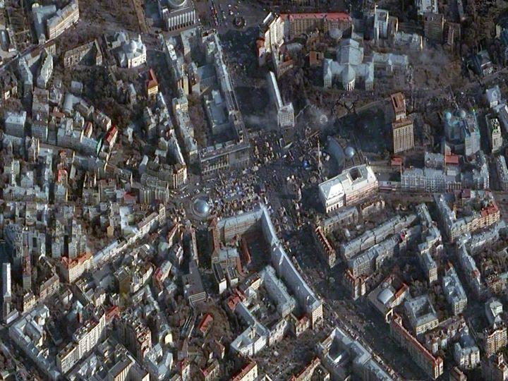
Governments are using overhead imagery to understand world events and how they change over time. For instance, they can compare imagery from protests in Kiev, Ukraine, that began in 2013 and escalated by the time this February 2014 photo was taken. The ability to monitor these activities with a growing and more diverse set of satellite options from commercial providers frees up classified satellites for different, more complex tasks.
Credit: DigitalGlobe

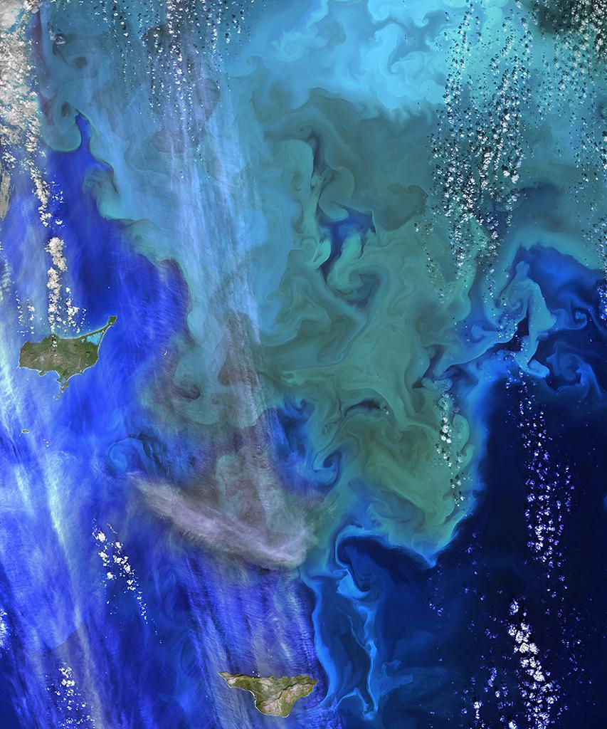
Imagery from space platforms is also being used to monitor the environment. Here, NASA’s Operational Land Imager spots a phytoplankton bloom (green and light blue shading) in the Bering Sea near Alaska. Images taken over time can help monitor the seasonal ebb and flow in the amount of phytoplankton, which helps to support a habitat for fish and birds.
Credit: NASA
Credit: NASA

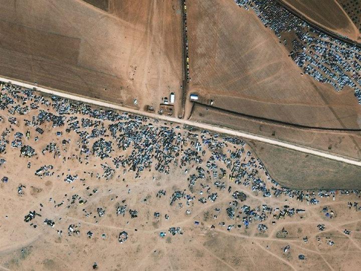
Global development organizations can use high-resolution images to aid their response to humanitarian crises such as in Kobane, Syria, in November 2014. Here, refugees are queuing up to flee the Syrian border. Such images reveal the vastness of patterns of human life, which can be helpful in providing aid as well as showing war planners where not to engage targets.
Credit: DigitalGlobe

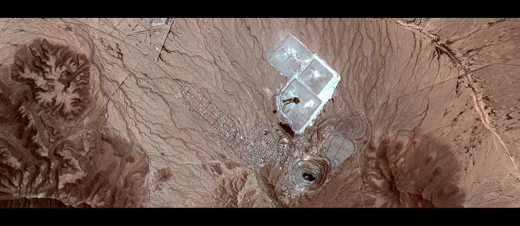
In some cases, the photos provide an unusual bird’s-eye view, as in this shot of the Arizona desert. This takes viewers to Arizona’s currently inactive New Cornelia copper mine in the Sonoran Desert and the adjacent mining town of Ajo. It is part of a strip of images that run from the Gulf of California to Ajo captured by a medium-resolution camera called Theia in April 2014. Even with medium-resolution imagery, analysts can gain valuable information.
Credit: Urthecast
Credit: Urthecast

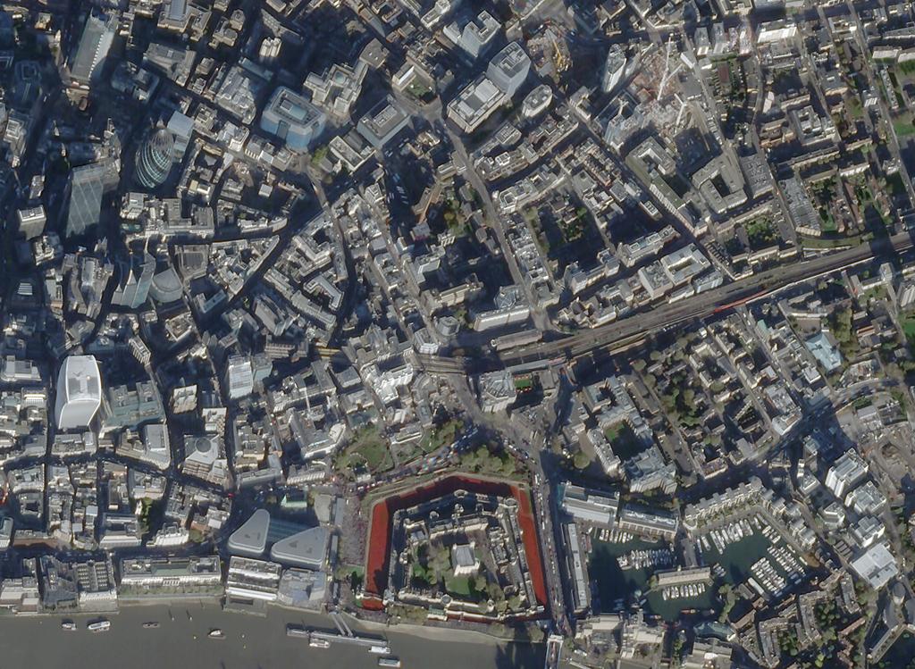
And overhead imagery allows us to commemorate historic events at worldwide landmarks. Here, SkySat-1 looks down on an installation at the Tower of London in 2014. At the installation, titled Blood Swept Lands and Seas of Red, the moat surrounding the tower was filled with ceramic poppies to honor those who died in World War I.
Credit: Skybox
Credit: Skybox
Click to enlarge.
The boom in small Earth-observation satellites is expanding a market in which businesses and governments alike can gather valuable insight for monitoring climate change, political hot spots, business activities and disaster zones.