HOUSTON—If the threat of severe thunderstorms materializes over Eastern New Mexico and the Texas Panhandle on June 8, the staff of a NASA project and its heavily instrumented high-altitude ER-2 jet aircraft plan to be there.
The goal is to gather data on how intense summer thunderstorms over the Central U.S. influence the Earth’s atmosphere and contribute to climate change.
The five-year study was initiated last summer by NASA’s Earth Sciences Div. and Dynamics and Chemistry of the Summer Stratosphere (DCOTSS). It seeks to better understand the effects of “overshooting storms” that generate rising air effects. They boost air, particles and chemicals in thunderstorms over the Midwest from the troposphere—or the lowest layer of the Earth’s atmosphere—into the higher altitude stratosphere, which most thunderstorms do not usually reach.
“Approximately 50,000 storms occur over the U.S. during a typical summer. So almost every day, somewhere in the U.S., overshooting storms are happening,” said Kenneth Bowman, a Texas A&M University professor of atmospheric science and the DCOTSS principal investigator. He participated in a June 7 NASA news briefing on the effort, a first.
“There are many scientific questions about the effects of these storms on the stratosphere that we will be able to address with data from DCOTSS,” he said. “These include the processes operating at the tops of these intense storms, the potential effects of man-made chemicals on the stratospheric ozone layer, and the sources and composition of aerosol particles in the stratosphere.”
Also participating in the briefing was Kate Calvin, NASA’s chief scientist and climate advisor. “We have been observing the Earth for decades. So, we can both see the state of the planet today and also how its changed over time,” Calvin said. She noted that the last eight years have been the warmest since modern weather record keeping began.
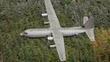
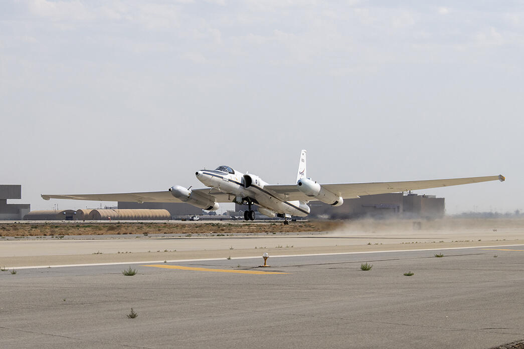
The DCOTSS airborne data-gathering effort began in 2021, a year later than planned because of the COVID-19 pandemic. This year’s data gathering relies on about 50 personnel. They include scientists from eight academic institutions, four NASA centers, the National Oceanic and Atmospheric Administration (NOAA) and the National Center for Atmospheric Research, all gathered at the Salina Regional Airport in Kansas. It is the operating base for the Lockheed ER-2 high-altitude flying laboratory provided by NASA’s Armstrong Research Center at Palmdale, California.
Last year’s DCOTSS campaign logged 11 of the data-gathering, 7-hr. flights that soar to 70,000 ft. This year’s flight campaign, which began in late May, has flown four times so far and is projected to end activities in Salina around June 30. The ER-2 and researchers plan to gather in Palmdale around July 11 for additional high-altitude data gathering, Bowman said.
Prior to the DCOTSS campaign, much was learned about thunderstorm activity using satellites and radar. Data from those sources revealed the overshooting phenomena occurs more often than presumed, with impacts that can affect the Earth’s protective high-altitude ozone layer and the ejection of water vapor into the stratosphere. That then becomes a potent greenhouse gas.
The ER-2 flights originating from Palmdale provide a different data set that helps to better characterize those over the more storm-intensive Midwest, according to findings so far.

Related Content