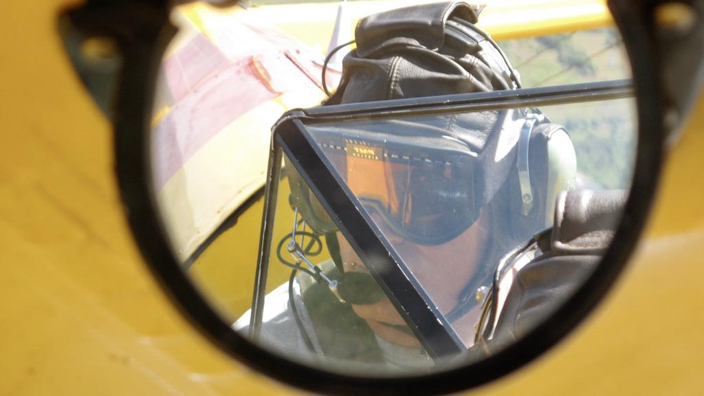
Pilots clad in leather helmets and sheepskin-lined jackets were paid by the U.S. Weather Bureau to collect atmospheric information in their open-cockpit biplanes.
Atmospheric sensing has undergone immense improvements in the last 100 years thanks to aircraft observations.
In 1919, pilots clad in leather helmets and sheepskin-lined leather jackets were paid by the U.S. Weather Bureau to collect atmospheric information in their open-cockpit biplanes. Rudimentary sensors attached to the biplane’s wing struts collected data on temperature, pressure and relative humidity. Pilots were given a 10% bonus for each 1,000 ft. above 13,500 ft., which in the non-pressurized, non-heated open cockpits resulted in dangerous exposure to frigid temperatures and hypoxia. Unfortunately, 12 pilots were killed between 1931-38 during these atmospheric data collection flights.
Our knowledge of the atmosphere has certainly benefited from brave aviators venturing into Mother Nature’s sometimes violent wrath. Reinforced aircraft deliberately penetrating thunderstorms, mountain wave rotors and hurricanes would fall into this description. This specialized field of atmospheric research has sought to better understand mountain wave turbulence, icing, hurricanes, high-altitude ice crystals and many other atmospheric phenomena. Certainly, the work done by these organizations is worthy of in-depth dissemination and insertion into our future training materials.
Unbeknownst to most commercial pilots is their own “contribution” to atmospheric data collection. While these endeavors are conducted during normal flights and certainly without the element of “adventuring into the unknown,” this wealth of data is contributing markedly to our understanding of the atmosphere and leading directly to more accurate weather forecasts. These relatively mundane contributions will be the focus of this article.
Aircraft Meteorological Data Relay

In recent decades, modern aircraft avionics have been modified to automatically collect and communicate meteorological data. This information provides more accurate, more timely and most importantly, a greater volume of upper-air data for meteorological applications, including support for weather-related forecasting and monitoring as well as for the aviation industry.
Established under the auspices of the World Meteorological Organization in 1998, the Aircraft Meteorological Data Relay (AMDAR) system facilitates the fully automated collection and transmission of weather observations from commercial aircraft, as well as some military and private aircraft. This is all done automatically by special sensors, software, and communication equipment without requiring any extra workload from a flight crew.
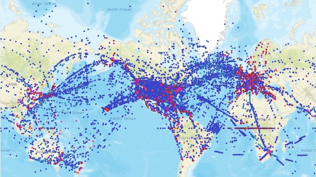
Aircraft participating in the AMDAR program utilize onboard sensors and flight computers to detect wind speed, direction and ambient temperature in that specific geographic position and time. Some aircraft also provide information on moisture, turbulence and ice accretion. The aeronautical communications systems then process, format and transmit the data to existing ground stations via satellite and VHF or HF radio links. About 230,000 observations per day are provided by this system.
One of the distinct advantages of using aircraft for weather sampling is the ability to collect widespread data from all around the globe, to include sparsely populated and under-developed regions where atmospheric sampling is limited. In some areas of the world, particularly over ocean areas, deserts, and near the poles, AMDAR soundings provide the only information available. Canada’s contributions to the AMDAR program include regional aircraft that provide observations from remote regions in Canada and at lower altitudes in the northern polar region.
Participating aircraft collect and report data not only while enroute but also during ascents and descents for many airports in different parts of the world, providing timely accurate information on the vertical structure of the atmosphere.
Given the high concentration of commercial air travel over the continental U.S. (CONUS), there is an expansive amount of data provided by the participating air carriers. Interestingly, the amount of incoming data varies by time of day and week. There are peaks in the data that correspond with evenings and early morning, causing a fourfold increase in data during these peaks.
Package carriers like UPS and FedEx Express generally do not fly on weekends, thus the weekend data input is about 60% of the mid-week value. Most data is gathered between FL250-FL400 and distributed fairly evenly over the CONUS. On the other hand, the data below FL 250 is concentrated around major air carrier hubs.
Incoming data from aircraft can also be decreased by extended periods of widespread inclement weather. For example, a major East Coast blizzard in January 2000 caused an 8% decrease in the data collected from across the nation because of cancelled flights from departure locations that were far removed from the blizzard.
How Aircraft Observations Improve Forecasts
Complexities in the physical sciences and engineering that were impossible to compute back in the era of slide rules and simple calculators are now possible with high-speed computers. This includes work by meteorologists who utilize supercomputers with complex mathematical models that perform millions of calculations per second to predict how weather conditions might change. The accuracy of these computational models are improved with large amounts of observational data collected from land, buoys, ships, upper air data from balloons, satellites and now, especially aircraft. Collectively, all of these sensors and gauges produce more than 1 million weather-related observations every day.
Aircraft-based observations have made a significant contribution to upper-air monitoring of the atmosphere and weather forecasting, according to the World Meteorological Organization’s Aircraft Based Observations program. The effort reaches wide across the scientific and aviation communities, to include individual airlines and their trade groups, government weather organizations, and prestigious universities.
The weather data has been particularly useful for nowcasting situations, where conditions are changing rapidly and are therefore of special use to the aviation industry. Areas where it has proved to have significant impact include: surface and upper-air forecasts of wind and temperature, including severe winds; thunderstorm genesis, location and severity; differentiation between rain, snow and freezing rain; and wind-shear location and intensity.
In addition to improving weather forecasting, the availability of frequent profile information and location of jet streams contributes to the increased accuracy of wind and temperature information used in flight planning (optimization of routes) and air traffic management, (such as continuous descents), and a reduction in the impact of weather on delays, holdings and diversions.
The National Weather Service Fort Worth Center Weather Service Unit (CWSU) found better resolution of the jet stream allowed improved control of aircraft spacing on descent, and the Seattle CWSU used this data to improve forecasts of Jetstream-induced turbulence. The UK Meteorological Office found the AMDAR data to be most important data source for winds over the Atlantic Ocean.
In Part 2 of this article, we describe how modern sensors and communications systems on advanced aircraft have become an ideal platform to measure important aspects of the atmosphere.


