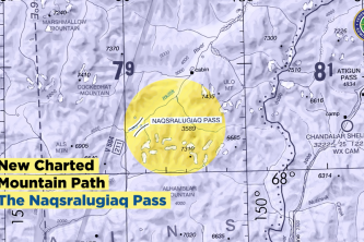
FAA Releases Sectional Charts for Alaska’s Brooks Range
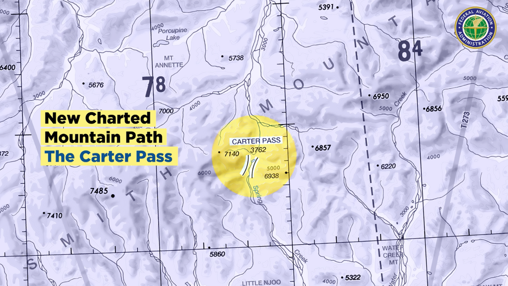
Two new mountain passes in Alaska’s Brooks Range are now displayed on sectional charts, as of March 24.
The new charts identify the Naqsralugiaq and Carters passes, with displayed elevations as high as 7,310 and 7,140 ft, respectively. The addition of these passes will allow pilots greater awareness and a safer path to their destinations.
“For years, pilots used routes known primarily to local fliers to navigate these passes,” says FAA Administrator Steve Dickson. “Now, all pilots will have the critical terrain information they need to fly safely.”
The production of these new charts is the result of a two-year collaboration between the FAA, the Aircraft Owners and Pilots Association (AOPA) and Alaskan aviation groups.
Apart from the addition of the passes, the new charts include new peak heights and improved labeling of mountain ranges. The FAA is also installing eight new Automated Weather Observing Systems (AWOS) in Alaska, aimed at providing weather data in remote parts of the state, by October.
“Adding these Brooks Range mountain passes is beneficial, especially to pilots not familiar with these areas,” says AOPA’s Alaska Regional Manager Tom George. “This is part of a larger joint industry/FAA effort to improve aviation safety by providing additional information on visual charts related to mountain passes. While currently focusing on Alaska, these processes will eventually extend to other mountainous parts of the country.”
The joint FAA/AOPA workgroup will continue to review chart accuracy and expects more updates soon.
Related Content


Comments