Aireon Alert Could Save Your Life

The pilot of a Cessna 210 Centurion that ditched off the Bahamas on Dec. 23, 2019 got an early Christmas present when a rescue helicopter began to hover over him.
He was treading water without a life jacket or raft and the aircraft had already sunk.
When the airplane went down the first thought was to send rescue forces to the last known radar fix when the aircraft was at 1,300 ft. Then a Civil Air Patrol team received a report from Aireon Alert that the actual last position recorded by space-based ADS-B was two miles away. That is where a Coast Guard helicopter was directed, and with drift calculations the rescue crew spotted the pilot in the water.
At the Irish Aviation Authority, Sean Patrick helped Aireon set up its alert service, which is free to any air navigation service provider (ANSP), rescue organization, airline or air safety regulator. Aireon, based in McLean, Virginia, is a joint venture between the satellite communications provider Iridium and ANSPs Nav Canada, NATS, Italy’s ENAV and the Irish Aviation Authority.
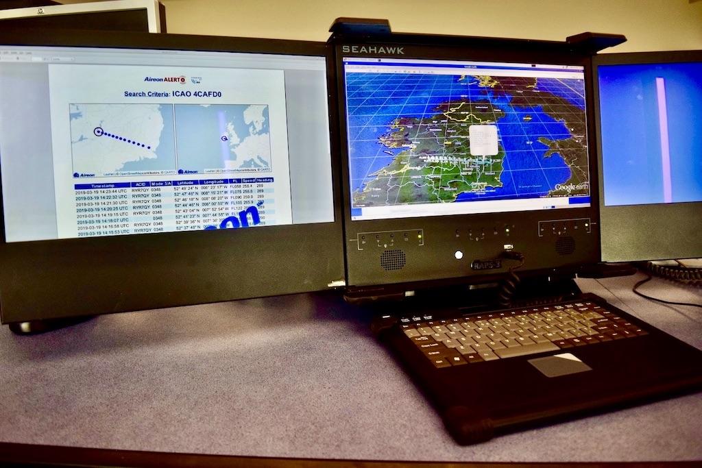
When Patrick’s team gets a call, it can provide an immediate verbal report to the requester and in just two minutes provide a report by email showing a geographical map of the last 15 minutes of ADS-B position reports on 1090 MHz with latitude, longitude, altitude and time. These fixes are once-per-minute except for the last minute where, depending on the ADS-B update rate achieved, the service can provide up to 12 fixes.
Space-Based ADS-B

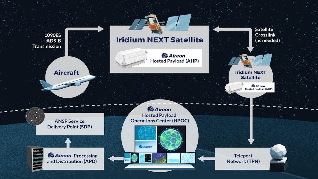
Aireon achieves pole-to-pole space-based ADS-B coverage with receiver payloads aboard 66 cross-linked Iridium Next satellites in low earth orbit at altitudes of 476 miles. If an aircraft is equipped to transmit its position on ADS-B, as is required now in many domestic airspaces, no extra equipment is needed to reach the satellites.
[On Oct. 26 during the World ATM Congress in Madrid, Isavia ANS, Iceland’s ANSP, announced an agreement with Aireon to expand its use of space-based ADS-B data. In December 2020, Isavia integrated Aireon’s data in its air traffic control operations for managed airspace below 70-degrees North latitude. With the latest agreement, Isavia will use Aireon’s live data feed for sectors above 70-degrees North latitude starting in March 2022.]
Aireon can provide Air Traffic Services surveillance in the 70% of the world’s surface where this coverage was not previously available. Since Aireon launched the Alert service in July 2019, there have been more than 100 requests for assistance and a number of saves recorded, the company reports. There are 400 organizations registered to use the service in about 120 countries.
One dramatic rescue occurred after a Pilatus PC-12 single-engine turboprop on a ferry flight with two crew ditched in the Pacific Ocean midway between California and Hawaii, 1,100 nm from land. Aireon Alert had tracked the aircraft down to sea level, which proved critical as rescue services were soon looking for the pilots in a two-person life raft in the middle of the Pacific. ADS-B continued to provide reports from the aircraft as it floated before sinking. Aireon Alert narrowed the search to just a single square km; the crew was found alive five hours later by a cargo ship sailing in the area.
Aireon Alert can only track cooperative targets, meaning aircraft broadcasting their position by ADS-B. But if ADS-B is turned off, the service would have reports right up until that moment, which Patrick said would let rescue services and investigators know exactly when the transmitter was turned off. The alert service does not contact registered organizations to notify them that a flight is in distress or missing.
Aireon and FlightAware—which is being acquired by Collins Aerospace—also offer the GlobalBeacon service for a fee that allows aircraft operators to continuously track their fleet movements and immediate notification of abnormal events.
To use the service, registered operators can consult a website with a pin code and enter the ICAO 24-bit address of the aircraft.
Patrick said the service would have been invaluable in the loss of Air France Flight AF447, an Airbus A330 flying from Rio de Janeiro in Brazil to Paris in 2009. Aireon Alert would have tracked the aircraft, which stalled and plummeted into the ocean, all the way down to sea level. This would have narrowed the search area down from the 1,000 sq. km. that recovery teams had to search to just 2-3 sq. km.
“It is a great, huge oceanic area, but with space-based ADS-B it can be tracked as if it were domestic airspace right down to sea level,” said Patrick. The service can also help in searches for aircraft that have gone missing over land and in remote areas like the Australian Outback. With a report received within two minutes’ time, the requester can make an informed decision of what action to take.


