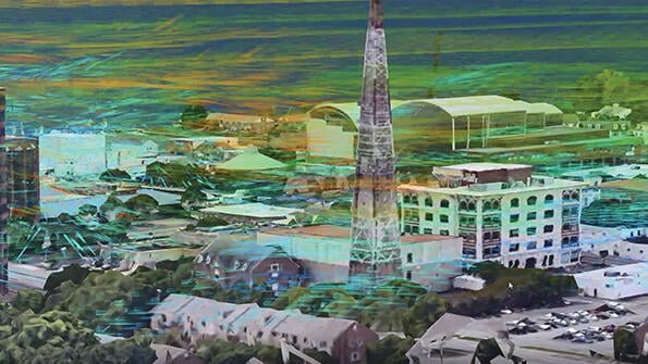
The test will use Doppler lidar to measure wind and cloud height.
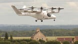
With cargo drone and air taxi companies aiming to launch operations within the next several years, NASA is pushing to better understand the urban weather in which they will operate.
- Lightweight, electric aircraft are sensitive to bad weather
- Predicting weather will be critical for smooth and profitable UAM operations
With that goal in mind, NASA awarded TruWeather Solutions a $750,000 Phase II Small Business Innovation Research contract in September to test a network of ground-based weather sensors in Hampton, Virginia.
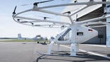
The sensor network is intended to provide weather measurement and prediction data for safe and efficient beyond-visual-line-of-sight flights of uncrewed air vehicles (UAV) and electric vertical-takeoff and-landing (eVTOL) aircraft flying at low altitudes within cities and suburban areas.
In particular, to facilitate the nascent urban air mobility (UAM) industry, microweather services are needed to improve UAV and eVTOL power management, payload weight estimates, travel times, flight separation and vertiport throughput, TruWeather says.
Currently, there are big gaps in what is known about urban weather, says TruWeather CEO Don Berchoff.
“Anywhere you have buildings, we don’t have weather models today that could tell you what the winds are going to do based on the building configurations,” he says. “This is a total mystery . . . that needs to get solved now because we’re going to be flying in urban areas with lighter aircraft.”
Also, for proposed cargo drones and eVTOL passenger aircraft, which are challenged by battery energy density limitations, bad weather could significantly limit operations. Without better meteorological data, UAM operators run the risk of being boxed in by bad weather, unable to find alternative routes and unable to fly, Berchoff says.
“You [have] got to worry if four people show up at the airport and their family is ready to go to Cancun and you tell them: ‘You have to leave Junior behind because the winds are a little too strong and the battery can’t carry all four of you,’” Berchoff says. “There are going to be problems.”
For lightweight cargo drones and eVTOLs, dealing with the weather in urban areas is very different from what major airlines deal with, he adds.
“They fly in the best-instrumented areas in the world around airports,” Berchoff says. “Drones and air taxis are not [flying in] well-instrumented areas. They can’t take as much weather without making people sick, and they can’t get above all the weather. This is the antithesis of what everyone’s used to.”
Despite the increasing numbers and sophistication of meteorological satellites, weather closer to the surface of the Earth, and especially in urban areas, is currently difficult to predict, Berchoff says.
“We need to have a from-the-ground-up approach,” he says.
As part of the test in Hampton, two Doppler lidars from Metro Weather of Japan will provide what TruWeather calls “MRI-like” wind and potential cloud-height data covering more than 30-40 mi.2, up to 6,000 ft. above the ground. TruWeather will fuse data from the lidars, 30 microweather stations in downtown Hampton, satellite data and possibly a radar to predict where and when it believes it is safe for UAVs and eVTOL vehicles to operate.
Nancy Mendonca, deputy in NASA’s Aeronautics Research Mission Directorate Mission Integration Office, says UAM weather networks will have to rely on a mix of old and new sensors, particularly less expensive and lower maintenance hardware.
“We’re looking to be able to use lower cost sensors and eventually even Internet of Things sensors,” she says.
Eventually, UAM weather monitoring will likely be incorporated into smart city initiatives, including networks of sensors that measure air quality and provide data to emergency services, Berchoff says.
Mendonca adds that UAM weather monitoring networks could benefit from connected or autonomous vehicles, for example, by crowdsourcing their ground temperature data to better feed weather models.
“In turn, we could provide precipitation information from the UAM sensor network back to ground transportation,” she says.
Ultimately, the goal is to better inform weather prediction models and provide enough accurate weather data to keep cargo drones and air taxi operations moving.
“We can really get more efficient flight time—we can schedule better, we can get more revenue per asset—if we know what these uncertainties are,” Berchoff says.

Related Content